
B 3.36 Mountains and Escarpments, Volcanic, Type 3
MsVm3, MsVh3, MsVv3, MvVm3, SMvVd3, SMvVm3, SvVm3
Soils: Dominant: Gn4.31, Gn2, Gn4.11 Brown and red gradational profiles (loam A horizons over silty clay loam B horizons), shallow to deep with variable stone/parent material content depending on topographical position and aspect. Friable in moist areas but may be hardsetting in drier areas and have a less intense colour (Gn4.51, Gn3.91, Gn1). Organic matter content and infiltration rates are greater for the moister areas with strong fine structure but less coarser structure and with a gritty (sandy) component throughout the profile.
Minor: Drier area soils range from shallow stony uniform profiles (Uc) to duplex (Dy, Dr; yellow and red) profiles, occasionally with A2 horizons where there is greater soil accumulation (weak/moderate structure in the B horizon).
Native vegetation: Dry Sclerophyll Forest, Wet Sclerophyll Forest, Cool Temperate Rainforest, Riparian Forest and minor occurrence of Rain-shadow Woodland. Major species include White Stringybark, Red Box, Longleafed Dogwood, Cherry Ballart, Narrow-leaved Peppermint, Messmate, Silver Wattle, Soft Tree-Fern, Blackwood, White Box.
Stone/rock outcrop: Moderate to very high. Rock exposures are common on steeper units particularly upper slopes, crests, drier aspects.
Pans: Nil or not observed
Land use: Snowy River National Park. Formed access to these map units is very limited.
Observed land deterioration: Minor sheet erosion
Susceptibility to land deterioration: Sheet and rill erosion (moderate to very high); Gully erosion (moderately low to very high); Compaction (low to moderately high). Dependant on soil development; Inundation/Waterlogging (very low to moderately low); Mass movement (moderately low to high).
Sites with laboratory data: Nil
Page top
| These units are based on the Snowy River Volcanics geological formation and have a number of lithologies; rhyodacite being predominant. These units are to the north of the Type 1 and Type 2 Volcanic map units and occur to the north, west and south of the Gelantipy Plateau. These units have much greater relative relief than the Hill units which means often rapid movement of water and incision by drainage lines. The drier area to the west has been deeply dissected by the Snowy River. The soil types range from shallow to deep friable gradational profiles in moister areas to shallow, stony uniform and gradational profiles in drier areas. The vegetation ranges from Cool Temperate Rainforest, Wet Sclerophyll Forest to Dry Sclerophyll Forest and some Riparian Forest. Geology: Dls; Devonian acid volcanics. Snowy River Volcanics. Rhyodacite, tuff, andesite, minor rhyolite and basalt. Also includes coarse sandstone and conglomerate, minor siltstone. Rainfall: Less than 700-1200 mm per annum, generally 700-1000 mm per annum. Slope: Variable; 10- greater than 100%. Often greater than 56%. Dominant landform element: Slope, scarp Minor landform element: Drainage depression | 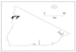 |
Soils: Dominant: Gn4.31, Gn2, Gn4.11 Brown and red gradational profiles (loam A horizons over silty clay loam B horizons), shallow to deep with variable stone/parent material content depending on topographical position and aspect. Friable in moist areas but may be hardsetting in drier areas and have a less intense colour (Gn4.51, Gn3.91, Gn1). Organic matter content and infiltration rates are greater for the moister areas with strong fine structure but less coarser structure and with a gritty (sandy) component throughout the profile.
Minor: Drier area soils range from shallow stony uniform profiles (Uc) to duplex (Dy, Dr; yellow and red) profiles, occasionally with A2 horizons where there is greater soil accumulation (weak/moderate structure in the B horizon).
Native vegetation: Dry Sclerophyll Forest, Wet Sclerophyll Forest, Cool Temperate Rainforest, Riparian Forest and minor occurrence of Rain-shadow Woodland. Major species include White Stringybark, Red Box, Longleafed Dogwood, Cherry Ballart, Narrow-leaved Peppermint, Messmate, Silver Wattle, Soft Tree-Fern, Blackwood, White Box.
Stone/rock outcrop: Moderate to very high. Rock exposures are common on steeper units particularly upper slopes, crests, drier aspects.
Pans: Nil or not observed
Land use: Snowy River National Park. Formed access to these map units is very limited.
Observed land deterioration: Minor sheet erosion
Susceptibility to land deterioration: Sheet and rill erosion (moderate to very high); Gully erosion (moderately low to very high); Compaction (low to moderately high). Dependant on soil development; Inundation/Waterlogging (very low to moderately low); Mass movement (moderately low to high).
Sites with laboratory data: Nil
© State of Victoria (Agriculture Victoria) 1996 - .

This work, Victorian Resources Online, is licensed under a Creative Commons Attribution 4.0 licence. You are free to re-use the work under that licence, on the condition that you credit the State of Victoria (Agriculture Victoria) as author, indicate if changes were made and comply with the other licence terms.
The licence does not apply to ‘branding’ or some ‘images or photographs’ that may be owned by third parties. We ask you to seek prior approval to use images using the VRO feedback form. Access to higher quality images can also be provided on request.
This page was last updated on .