
B 3.33 Mountains and Escarpments, Granitic, Type 7
MsGv7, MvGh7, MvGv7, SMvGv7, SvGv7
Soils: Dominant: Gn4.31, Gn4.11 Shallow, deep red and brown gradational profiles, well drained with weak coarse structure but a strong fine structure with a coarse sandy component throughout. Textural change from a sandy loam A horizon to a sandy clay loam/sandy clay B horizon depending on soil development: less development and stonier on steeper mid-slopes.
Minor: Red and brown friable Gradational profiles on metamorphic and sedimentary parent material, with finer textures than granitic counterparts.
Native vegetation: Wet Sclerophyll Forest predominates with some Shining Gum and Mountain Grey Gum with other gums e.g. River Peppermint. Cool Temperate Rainforest and Riparian Forest and Montane Sclerophyll Forest are also represented here along drainage lines, drainage depressions and some gentle slopes. The high rainfall is a dominant factor in species location and the lush growth, with an understorey including Hazel Pomaderris (Pomaderris aspera) and Blanket leaf.
Stone/rock outcrop: Minor/moderate. More pronounced on steeper upper and mid slopes within these units.
Pans: Nil.
Land use: These units which are forested are either in the Errinundra National Park or in State Forest (available for timber harvesting given the appropriate guidelines and prescriptions).
Observed land deterioration: Minor to moderate. Sheet and rill erosion, occasional bank slumping on exposed, steep batter.
Susceptibility to land deterioration: Sheet and rill erosion (low to very high); Gully erosion (low to moderately high); Compaction (low to moderately high); Bank erosion (low); inundation/Waterlogging (very low to moderately low); Mass movement (low to high).
Sites with laboratory data: Nil.
Page top
| These units are found on the Ellery Granodiorite pluton on and around the edge of the Errinundra Plateau incorporating the Plateau surface, dissected (scarp) face and dissected remnants. These units incorporate some of the wettest areas of the study area. A local rainfall collection site has an average annual rainfall of nearly 1800 mm with frequent recordings of over 2000 mm. The soils predominantly have gradational profiles; friable, well drained and generally much more stable (with vegetation cover) than other granitic soils in drier areas. Soil textures are generally sandy loams grading to sandy clay loams with a gritty component throughout. The vegetation is predominantly Wet Sclerophyll Forest with Cool Temperate Rainforest, Riparian Forest and Montane Sclerophyll Forest in drainage lines and some lower slopes. There may be minor occurrences of sedimentary and metamorphic rocks (narrow north/south bands) within these units, especially in the vicinity of Christians Road. Geology: Dgl6; Devonian Granodiorite (Ellery Granodiorite). Rainfall: 1000 to greater than 1200 mm per annum. Slope: 32-100%. Dominant landform element: Slope. Minor landform element: Broad crest, drainage depression. | 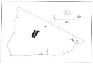 |
Soils: Dominant: Gn4.31, Gn4.11 Shallow, deep red and brown gradational profiles, well drained with weak coarse structure but a strong fine structure with a coarse sandy component throughout. Textural change from a sandy loam A horizon to a sandy clay loam/sandy clay B horizon depending on soil development: less development and stonier on steeper mid-slopes.
Minor: Red and brown friable Gradational profiles on metamorphic and sedimentary parent material, with finer textures than granitic counterparts.
Native vegetation: Wet Sclerophyll Forest predominates with some Shining Gum and Mountain Grey Gum with other gums e.g. River Peppermint. Cool Temperate Rainforest and Riparian Forest and Montane Sclerophyll Forest are also represented here along drainage lines, drainage depressions and some gentle slopes. The high rainfall is a dominant factor in species location and the lush growth, with an understorey including Hazel Pomaderris (Pomaderris aspera) and Blanket leaf.
Stone/rock outcrop: Minor/moderate. More pronounced on steeper upper and mid slopes within these units.
Pans: Nil.
Land use: These units which are forested are either in the Errinundra National Park or in State Forest (available for timber harvesting given the appropriate guidelines and prescriptions).
Observed land deterioration: Minor to moderate. Sheet and rill erosion, occasional bank slumping on exposed, steep batter.
Susceptibility to land deterioration: Sheet and rill erosion (low to very high); Gully erosion (low to moderately high); Compaction (low to moderately high); Bank erosion (low); inundation/Waterlogging (very low to moderately low); Mass movement (low to high).
Sites with laboratory data: Nil.
© State of Victoria (Agriculture Victoria) 1996 - .

This work, Victorian Resources Online, is licensed under a Creative Commons Attribution 4.0 licence. You are free to re-use the work under that licence, on the condition that you credit the State of Victoria (Agriculture Victoria) as author, indicate if changes were made and comply with the other licence terms.
The licence does not apply to ‘branding’ or some ‘images or photographs’ that may be owned by third parties. We ask you to seek prior approval to use images using the VRO feedback form. Access to higher quality images can also be provided on request.
This page was last updated on .