
B 3.32 Mountains and Escarpments, Granitic, Type 2
MsGm2, MsGh2, SsGm2, SvGm2
Soils: Dominant: Gn4, Gn2, Dy3, Db2. Shallow to moderately deep brown friable gradational profiles, strongly structured (fine) with coarse material throughout with loamy sand A horizons and sandy clay loam B horizons. Deeper gradational to duplex profiles on lower slopes, with A12/A2 horizon development in drier areas on colluvial accumulated material and may be mottled (less stable than the gradational profiles in the moister areas).
Minor: Uc; Uniform coarse profile where parent rock outcrops.
Native vegetation: Lowland Sclerophyll Forest dominates these upmap units. Predominant species are Stringybarks with some Silvertop with some gums; Mountain Grey Gum and indicative moister climatic understorey in the moister areas and aspects.
Stone/rock outcrop: Crest; peak, at Genoa Peak and on main ridge crests.
Pans: Nil or not observed.
Land use: Native forest, designated State Forest used for hardwood production and some minor grazing on some reclaimed plain units.
Observed land deterioration: Some sheet erosion (minor) on the upper slopes, but greater erosion potential on drier and lower, (colluvial) slopes. Waterlogging on plains units. Some bank erosion.
Susceptibility to land deterioration: Sheet and rill erosion (moderate to very high); Gully erosion (moderately low to high); Compaction (moderately low to high); Waterlogging (low to very high in plains units); Mass movement (low to high).
Sites with laboratory data: Nil.
Page top
| These units are steeper units associated with the previous low hills and hills units but having the distinction of greater relative relief as well as steeper slopes. Examples are the escarpment of Mt. Merragunegin and Genoa Peak which has its own distinctive pinkish granite Aspect and topographic position are important factors in the distribution of soil and vegetation types in these units. For example upper slopes have a developing friable, structured gradational profile which shows much greater stability than the deeper, more duplex profiles on lower slopes which are generally drier, except in drainage lines. Geology: Dgl2; Devonian granite (Maramingo Granite). Rainfall: 700-1000 mm per annum, generally less than 1000 mm per annum. Slope: 32-100%, generally <56%. Dominant landform element: Slope. Minor landform element: Rocky crest. | 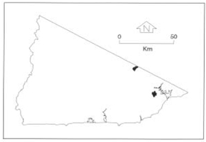 |
Soils: Dominant: Gn4, Gn2, Dy3, Db2. Shallow to moderately deep brown friable gradational profiles, strongly structured (fine) with coarse material throughout with loamy sand A horizons and sandy clay loam B horizons. Deeper gradational to duplex profiles on lower slopes, with A12/A2 horizon development in drier areas on colluvial accumulated material and may be mottled (less stable than the gradational profiles in the moister areas).
Minor: Uc; Uniform coarse profile where parent rock outcrops.
Native vegetation: Lowland Sclerophyll Forest dominates these upmap units. Predominant species are Stringybarks with some Silvertop with some gums; Mountain Grey Gum and indicative moister climatic understorey in the moister areas and aspects.
Stone/rock outcrop: Crest; peak, at Genoa Peak and on main ridge crests.
Pans: Nil or not observed.
Land use: Native forest, designated State Forest used for hardwood production and some minor grazing on some reclaimed plain units.
Observed land deterioration: Some sheet erosion (minor) on the upper slopes, but greater erosion potential on drier and lower, (colluvial) slopes. Waterlogging on plains units. Some bank erosion.
Susceptibility to land deterioration: Sheet and rill erosion (moderate to very high); Gully erosion (moderately low to high); Compaction (moderately low to high); Waterlogging (low to very high in plains units); Mass movement (low to high).
Sites with laboratory data: Nil.
© State of Victoria (Agriculture Victoria) 1996 - .

This work, Victorian Resources Online, is licensed under a Creative Commons Attribution 4.0 licence. You are free to re-use the work under that licence, on the condition that you credit the State of Victoria (Agriculture Victoria) as author, indicate if changes were made and comply with the other licence terms.
The licence does not apply to ‘branding’ or some ‘images or photographs’ that may be owned by third parties. We ask you to seek prior approval to use images using the VRO feedback form. Access to higher quality images can also be provided on request.
This page was last updated on .