
B 3.31 Hills, Sedimentary, Type 3
HrSm3, HrSh3, HsSm3
Soils: Dominant: Gn, Dy3.11, Db3.11, Dr2.11. Moderately deep to deep gradational and duplex profiles depending on topographic position and aspect. Subsoil development is subject to parent material variations such that coarser conglomerate produces a coarser soil profile and a denser finer more structured B horizon (subsoil) is formed on siltstones, mudstones and fine sandstones. The A horizon textures are generally organic loam and light medium to medium clay in the B horizon. Apart from moister areas these soils tend to be hardsetting. Surface organic matter horizon tend to be loose and have variable depth, but are generally shallow.
Minor: Gn/Uc/Um; Shallow, stony profile with shallow loose organic horizon overlying the mineral horizon grading quickly into parent material.
Native vegetation: The vegetation is predominantly Dry Sclerophyll Forest with Stringybark associations principally White Stringybark, Yellow Stringybark, Narrow-leafed Peppermint and Silvertop with a dry climate understorey (heath, wire grass (Tetrarhena juncea) and some shrubs). There is also some Wet Sclerophyll Forest and Riparian Forest associated with the drainage depressions. Species such as Red Stringybark, Blue-leafed Stringybark (E. agglomerota) and Blue Box (E. bauerana) occur on drier ridges.
Stone/rock outcrop: Moderate to high. Stony, particularly on ridges and where the drainage system has incised into the land; immediate tributaries to Genoa Gorge.
Pans: Nil or not observed.
Land use: Forested apart from rocky areas. These units are within the Coopracambra National Park and have limited formed access.
Observed land deterioration: Sheet erosion, creep, minor rock movement.
Susceptibility to land deterioration: Sheet and rill erosion (moderate to very high); Gully erosion (moderate); Compaction (moderately low to moderately high); Water logging/Inundation (very low to moderate); Mass movement (low to very high); Bank erosion (low to moderate).
Sites with laboratory data: 201.
Page top
| These Hills units are formed on Devonian sediments which have a distinct ‘red bed' component and also include a coarse sand (fine gravel, sandstone/conglomerate which is highlighted in this grouping (Genoa Beds) located around the Genoa River near the New South Wales border. The major unit has rolling topography while the other units are steep or very steep but with only sufficient relative relief to be designated a Hill. The soil types range from skeletal profiles on upper slopes to deep gradational and duplex (yellow, brown and red) on the mid and lower slopes. The vegetation is Dry Sclerophyll Forest with some Riparian Forest in drainage depressions. Geology: Duc; Devonian sediments (Genoa Beds). Sandstone, siltstone, mudstone, shale, "red beds", conglomerate. Rainfall: 700-1000 mm per annum. Slope: 10-100%, generally 10-32%. Dominant landform element: Slope, broad crest, incised drainage line. Minor landform element: Drainage depression. | 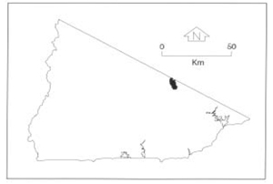 |
Soils: Dominant: Gn, Dy3.11, Db3.11, Dr2.11. Moderately deep to deep gradational and duplex profiles depending on topographic position and aspect. Subsoil development is subject to parent material variations such that coarser conglomerate produces a coarser soil profile and a denser finer more structured B horizon (subsoil) is formed on siltstones, mudstones and fine sandstones. The A horizon textures are generally organic loam and light medium to medium clay in the B horizon. Apart from moister areas these soils tend to be hardsetting. Surface organic matter horizon tend to be loose and have variable depth, but are generally shallow.
Minor: Gn/Uc/Um; Shallow, stony profile with shallow loose organic horizon overlying the mineral horizon grading quickly into parent material.
Native vegetation: The vegetation is predominantly Dry Sclerophyll Forest with Stringybark associations principally White Stringybark, Yellow Stringybark, Narrow-leafed Peppermint and Silvertop with a dry climate understorey (heath, wire grass (Tetrarhena juncea) and some shrubs). There is also some Wet Sclerophyll Forest and Riparian Forest associated with the drainage depressions. Species such as Red Stringybark, Blue-leafed Stringybark (E. agglomerota) and Blue Box (E. bauerana) occur on drier ridges.
Stone/rock outcrop: Moderate to high. Stony, particularly on ridges and where the drainage system has incised into the land; immediate tributaries to Genoa Gorge.
Pans: Nil or not observed.
Land use: Forested apart from rocky areas. These units are within the Coopracambra National Park and have limited formed access.
Observed land deterioration: Sheet erosion, creep, minor rock movement.
Susceptibility to land deterioration: Sheet and rill erosion (moderate to very high); Gully erosion (moderate); Compaction (moderately low to moderately high); Water logging/Inundation (very low to moderate); Mass movement (low to very high); Bank erosion (low to moderate).
Sites with laboratory data: 201.
© State of Victoria (Agriculture Victoria) 1996 - .

This work, Victorian Resources Online, is licensed under a Creative Commons Attribution 4.0 licence. You are free to re-use the work under that licence, on the condition that you credit the State of Victoria (Agriculture Victoria) as author, indicate if changes were made and comply with the other licence terms.
The licence does not apply to ‘branding’ or some ‘images or photographs’ that may be owned by third parties. We ask you to seek prior approval to use images using the VRO feedback form. Access to higher quality images can also be provided on request.
This page was last updated on .