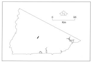
B 3.30 Hills, Limestone, Type 1
HrLh1, HrLv1, PgAh0
Soils: Dominant: Gn3.12, Gn3.13, Gn4.21 Dr, Dy3.11, Dy5.11. On the Hill unit mid slope is a friable red/black (B horizon colour: 2.5YR 3/6); deep profile with limestone floaters in the profile and is strongly structured with a neutral to slightly alkaline pH. Texture ranges from organic loam/silty loam A horizons to light medium clay B horizons. The flat plain must have a duplex profile (occasional gradational) of loam A horizon and silty clay/light clay B horizon without an A2 horizon and is only weakly to moderately well structured and faintly mottled at depth (>1 m).
Minor: Shallow red/brown gradational profiles on upper, drier slopes and aspects.
Native vegetation: The Hills unit is generally covered with Wet Sclerophyll Forest Narrow-leaved Peppermint, White Stringybark, Silver Wattle with some Dry Sclerophyll Forest of White, Yellow and Brown Stringybark and Riparian Forest: Manna Gum, Mountain Grey Gum. The vegetation is generally closed tall forest with greater understorey growth in Wet Sclerophyll Forest.
Stone/rock outcrop: Minor; Rock bars in major streams, crests.
Pans: Nil or not observed.
Land use: The Hill unit is predominantly native forest designated State Forest whilst the other units have been cleared (freehold). A small proportion of freehold land above Boulder Flat has been partially cleared and mining activity has been carried out excavating for calcrenetic material, but is currently abandoned. Boulder Flat itself (comprising of terraces) has been cleared and is used for grazing.
Observed land deterioration: Sheet erosion where land is disturbed. Some minor streambank erosion.
Susceptibility to land deterioration: Sheet and rill erosion (low to moderate); Gully erosion (low to moderate); Compaction (low to moderately high); Streambank erosion (low to moderate); Waterlogging/Inundation (low to high).
Sites with laboratory data: 21, 22, 23.
Page top
| This group of units covers an outcrop of limestone and acid volcanic material at Boulder Flat, north of Club Terrace. There is a cleared Plains unit (Boulder Flat) which is also included and consists of a number of terraces. The main Hill unit is rolling with occasional steeper slopes in a generally moist climate. The soil types are gradational profiles, deep on mid to lower slopes with variable parent material in the profile. Some slates and purple sediments are associated with the limestone as well as rhyodacite/coarse sandstone, outcropping in the drainage line. The Plains unit has a duplex depositional profile. The vegetation is predominantly Wet Sclerophyll Forest with some Dry Sclerophyll Forest and Riparian Forest, depending on aspect and topographic position. Geology: Dla; Buchan Caves limestone. Dls; Snowy River Volcanics. Qra; Floodplain deposits. Rainfall: 1000 to greater than 1200 mm per annum. Slope: Variable, 0-56%, generally 10-32%. Dominant landform element: Slope, flat (terraces). Minor landform element: Drainage depression. |  |
Soils: Dominant: Gn3.12, Gn3.13, Gn4.21 Dr, Dy3.11, Dy5.11. On the Hill unit mid slope is a friable red/black (B horizon colour: 2.5YR 3/6); deep profile with limestone floaters in the profile and is strongly structured with a neutral to slightly alkaline pH. Texture ranges from organic loam/silty loam A horizons to light medium clay B horizons. The flat plain must have a duplex profile (occasional gradational) of loam A horizon and silty clay/light clay B horizon without an A2 horizon and is only weakly to moderately well structured and faintly mottled at depth (>1 m).
Minor: Shallow red/brown gradational profiles on upper, drier slopes and aspects.
Native vegetation: The Hills unit is generally covered with Wet Sclerophyll Forest Narrow-leaved Peppermint, White Stringybark, Silver Wattle with some Dry Sclerophyll Forest of White, Yellow and Brown Stringybark and Riparian Forest: Manna Gum, Mountain Grey Gum. The vegetation is generally closed tall forest with greater understorey growth in Wet Sclerophyll Forest.
Stone/rock outcrop: Minor; Rock bars in major streams, crests.
Pans: Nil or not observed.
Land use: The Hill unit is predominantly native forest designated State Forest whilst the other units have been cleared (freehold). A small proportion of freehold land above Boulder Flat has been partially cleared and mining activity has been carried out excavating for calcrenetic material, but is currently abandoned. Boulder Flat itself (comprising of terraces) has been cleared and is used for grazing.
Observed land deterioration: Sheet erosion where land is disturbed. Some minor streambank erosion.
Susceptibility to land deterioration: Sheet and rill erosion (low to moderate); Gully erosion (low to moderate); Compaction (low to moderately high); Streambank erosion (low to moderate); Waterlogging/Inundation (low to high).
Sites with laboratory data: 21, 22, 23.


