
B 3.3 Plains, Alluvial, Type 1
PlAm1, PlgAm1, PgAm1
Soils: Dominant: Dd, Dy, Um. Less well drained areas often have dark duplex or gradational profiles with loam to silty loam topsoils and silty clay or heavier subsoils (B horizons). They are often moderately well structured have a moderate to high shrink swell capacity, may have self-mulching characteristics in places and are susceptible to compaction. The pH trend is neutral and organic matter content is probably higher than the other soil types. The uniform (medium textured) profiles are dark to mid-brown fine sandy loams or silts (occasionally duplex) and have better drainage than the heavier duplex soils. These lighter soils occur on levee banks (Site 165).
Minor: Uc. Areas of uniform (coarse) profiles; sand and gravel lenses.
Native vegetation: Minor occurrences only. Previous cover: Lowland Sclerophyll Forest, Coastal Sclerophyll Forest, Coastal Banksia Woodland, Riparian and Warm Temperate Forest. There are occasional Southern Mahogany along the Snowy River.
Stone/rock outcrop: Nil.
Pans: Nil or not observed.
Land use: Virtually all of these units have freehold status and have been cleared and drained for agricultural purposes. Dairying, market gardening and general grazing are the main uses. This is the most intensively used land in the study area.
Observed land deterioration: Compaction, pugging, streambank erosion, reduction in organic matter.
Susceptibility to land deterioration: Sheet and rill erosion (very low to moderate); Gully erosion (very low to moderate); Compaction (low to high); Inundation/Waterlogging (moderate to very high); Mass movement (very low to moderately low).
Sites with laboratory data: 165
Page top
| These units account for the Snowy River floodplain near Orbost and are based on the recent alluvial material that makes up the floodplain area; floodplain, levees, terraces, ox-bow lakes (billabongs) and previous water course alignments. These sediments are of Recent (Quaternary) origin. The Plain units extend from west of Orbost to the base of Mt. Raymond to the east and southward merge into coastal flats at the base of the Marlo Tertiary outcrop. The Cabbage Tree floodplain joins this system. The range of soils in these units is variable due to varied rates and type of deposited material e.g. pebbles, gravel, sand, silt and clay. The native vegetation has been almost totally cleared but Lowland Sclerophyll Forest, Coastal Sclerophyll Forest, Riparian Forest and Warm Temperate Forest were all probably present. Geology: Qra, Qr1, Qp5; Recent and Pleistocene (Quaternary) alluvium. Sand, gravel, silt and minor clay. Rainfall: 700-1000 mm per annum. Slope: 0-10%, generally less than 3%. Dominant landform element: Plain, open depressions, drainage depressions. Minor landform element: Terrace. | 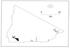 |
Soils: Dominant: Dd, Dy, Um. Less well drained areas often have dark duplex or gradational profiles with loam to silty loam topsoils and silty clay or heavier subsoils (B horizons). They are often moderately well structured have a moderate to high shrink swell capacity, may have self-mulching characteristics in places and are susceptible to compaction. The pH trend is neutral and organic matter content is probably higher than the other soil types. The uniform (medium textured) profiles are dark to mid-brown fine sandy loams or silts (occasionally duplex) and have better drainage than the heavier duplex soils. These lighter soils occur on levee banks (Site 165).
Minor: Uc. Areas of uniform (coarse) profiles; sand and gravel lenses.
Native vegetation: Minor occurrences only. Previous cover: Lowland Sclerophyll Forest, Coastal Sclerophyll Forest, Coastal Banksia Woodland, Riparian and Warm Temperate Forest. There are occasional Southern Mahogany along the Snowy River.
Stone/rock outcrop: Nil.
Pans: Nil or not observed.
Land use: Virtually all of these units have freehold status and have been cleared and drained for agricultural purposes. Dairying, market gardening and general grazing are the main uses. This is the most intensively used land in the study area.
Observed land deterioration: Compaction, pugging, streambank erosion, reduction in organic matter.
Susceptibility to land deterioration: Sheet and rill erosion (very low to moderate); Gully erosion (very low to moderate); Compaction (low to high); Inundation/Waterlogging (moderate to very high); Mass movement (very low to moderately low).
Sites with laboratory data: 165
© State of Victoria (Agriculture Victoria) 1996 - .

This work, Victorian Resources Online, is licensed under a Creative Commons Attribution 4.0 licence. You are free to re-use the work under that licence, on the condition that you credit the State of Victoria (Agriculture Victoria) as author, indicate if changes were made and comply with the other licence terms.
The licence does not apply to ‘branding’ or some ‘images or photographs’ that may be owned by third parties. We ask you to seek prior approval to use images using the VRO feedback form. Access to higher quality images can also be provided on request.
This page was last updated on .