
B 3.29 Hills, Granitic, Type 9
HsGm9, HsGh9, PgAm0, PgAh
Minor: Shallow to deep brown and red gradational profiles occur in moister areas particularly the upper slopes, higher elevations. Multi-layered (uniform and duplex) profiles occur in drainage lines and flats.
Native Vegetation: The vegetation is predominantly Dry Sclerophyll Forest with Narrow-leaved Peppermint, some Stringybarks; White and Yellow Stringybarks and some gums, with a more open canopy and sparse understorey. The moister areas have denser vegetation growth including understorey and greater tree growth, with species such as Brown-barrel Ash and Mountain Grey Gum.
Stone/rock outcrop: Moderate on spurs, crests; low on lower slopes.
Pans: Occasional nodulisation and hardsetting (cemented) A2/A3 horizons.
Land use: Predominantly native forest classified as State Forest and therefore available to hardwood production. There are a number of freehold blocks around Goongerah, mainly in the valley on the Brodribb River flats. There is a camping site which is part of the Baldwin Spencer Trail tourist route.
Observed land deterioration: Sheet and rill erosion, some gullying and tunnelling, particularly associated with clearing and bank erosion in drier areas.
Susceptibility to land deterioration: Sheet and rill erosion (low to very high); Gully erosion (moderately low to very high); Compaction (low to high); Inundation/Waterlogging (low to moderately high); Bank/Tunnel erosion (moderately low to very high).
Sites with laboratory data: Nil.
Page top
| These units are either rolling or steep hills on Granodiorite in the Goongerah area extending from south of Goongerah north to Brown Mountain and the head of the Errinundra plateau. An alluvial Plains unit is also included in this group (floodplain and terraces), being surrounded by granitic Hill units. The soils are shallow to deep brown and red friable coarse gradational profiles in moister areas (higher elevations and topographic positions), while mid and lower slopes, particularly in drier areas have duplex profiles (generally yellow and brown) which are more erodible. Vegetation is predominantly Dry Sclerophyll Forest with some Wet Sclerophyll Forest and Riparian Forest in moister areas and major drainage lines. Geology: Dgl; Devonian Granodiorite/Granite. Rainfall: 700-1200 mm per annum. Slope: 0-56%, generally 32-56%. Dominant landform element: Slope. Minor landform element: Drainage depression, terraces (flats). | 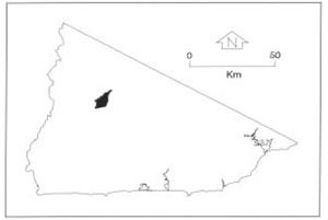 |
Soils
: Dominant: Dy3.21, Dy3.42, Db: Yellow and brown duplex soils in drier areas on lower and mid slopes. Sandy loam upper A horizons weakly structured, overlie a massive loamy sand A2 horizon (occasionally conspicuously bleached), sometimes overlie a clayey loamy sand A3. These A horizons clearly overlie a coarse gritty medium clay, moderately well structured B horizon which is moderately mottled. The B horizon generally grades into weathered parent material at depths of 2.0 m or more.Minor: Shallow to deep brown and red gradational profiles occur in moister areas particularly the upper slopes, higher elevations. Multi-layered (uniform and duplex) profiles occur in drainage lines and flats.
Native Vegetation: The vegetation is predominantly Dry Sclerophyll Forest with Narrow-leaved Peppermint, some Stringybarks; White and Yellow Stringybarks and some gums, with a more open canopy and sparse understorey. The moister areas have denser vegetation growth including understorey and greater tree growth, with species such as Brown-barrel Ash and Mountain Grey Gum.
Stone/rock outcrop: Moderate on spurs, crests; low on lower slopes.
Pans: Occasional nodulisation and hardsetting (cemented) A2/A3 horizons.
Land use: Predominantly native forest classified as State Forest and therefore available to hardwood production. There are a number of freehold blocks around Goongerah, mainly in the valley on the Brodribb River flats. There is a camping site which is part of the Baldwin Spencer Trail tourist route.
Observed land deterioration: Sheet and rill erosion, some gullying and tunnelling, particularly associated with clearing and bank erosion in drier areas.
Susceptibility to land deterioration: Sheet and rill erosion (low to very high); Gully erosion (moderately low to very high); Compaction (low to high); Inundation/Waterlogging (low to moderately high); Bank/Tunnel erosion (moderately low to very high).
Sites with laboratory data: Nil.
© State of Victoria (Agriculture Victoria) 1996 - .

This work, Victorian Resources Online, is licensed under a Creative Commons Attribution 4.0 licence. You are free to re-use the work under that licence, on the condition that you credit the State of Victoria (Agriculture Victoria) as author, indicate if changes were made and comply with the other licence terms.
The licence does not apply to ‘branding’ or some ‘images or photographs’ that may be owned by third parties. We ask you to seek prior approval to use images using the VRO feedback form. Access to higher quality images can also be provided on request.
This page was last updated on .