
B 3.28 Hills, Granitic, Type 8
HrGv8, HsGv8, HvGv8
Native vegetation: Montane Forest with Snow Gum occasionally Candlebark and Silver Wattle occurs around Mt Ellery and in the vicinity of Goonmirk Rocks. Wet Sclerophyll Forest is also present particularly on the mid/lower slopes of these units and Cool Temperate Rainforest occupies drainage lines and drainage depressions.
Stone/rock outcrop: High. Mainly on upper slopes and crests; large outcrops (tors).
Pans: Nil.
Land use: Both these units fall within the Errinundra National Park, and both are sight-seeing landmarks within the Park: conservation and recreation.
Observed land deterioration: Sheet erosion accentuated by trampling.
Susceptibility to land deterioration: Sheet and rill erosion (low to high); Gully erosion (moderately low to moderate); Compaction (low to moderately high); Mass movement (low to moderate).
Sites with laboratory data: Nil
Page top
| This small group of units consists of two rocky outcrops which are part of the Ellery Granodiorite pluton. These two outcrops are Goonmirk Rocks and Mt. Ellery which are the highest points in the area and receive a high rainfall (often >1800 mm per annum). The soils are generally shallow, stony with organic brown and red gradational profiles where soil has developed interposed by stone and/or rock outcrops. The rock outcrops generally occur on the crest and upper slopes. The vegetation is sparse on the crest and upper slopes where Montane forest may occur with Wet Sclerophyll Forest on the lower slopes of this unit and some Cool Temperate Rainforest in depressions. Geology: Dgl6; Devonian Granodiorite (Ellery Granodiorite). Rainfall: Greater than 1200 mm per annum. Slope: Variable; 10-100%. Dominant landform element: Crests, slope. Minor landform element: Tors. | 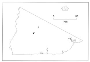 |
Soils
: Dominant: Gn4.11, Gn4.31, Gn3.31. Brown and red gradational profiles which are generally shallow, but deeper on lower slopes, with organic friable sandy loam A horizons grading into moderately to strongly structured sandy clay loams to gritty sandy clay B horizons.Native vegetation: Montane Forest with Snow Gum occasionally Candlebark and Silver Wattle occurs around Mt Ellery and in the vicinity of Goonmirk Rocks. Wet Sclerophyll Forest is also present particularly on the mid/lower slopes of these units and Cool Temperate Rainforest occupies drainage lines and drainage depressions.
Stone/rock outcrop: High. Mainly on upper slopes and crests; large outcrops (tors).
Pans: Nil.
Land use: Both these units fall within the Errinundra National Park, and both are sight-seeing landmarks within the Park: conservation and recreation.
Observed land deterioration: Sheet erosion accentuated by trampling.
Susceptibility to land deterioration: Sheet and rill erosion (low to high); Gully erosion (moderately low to moderate); Compaction (low to moderately high); Mass movement (low to moderate).
Sites with laboratory data: Nil
© State of Victoria (Agriculture Victoria) 1996 - .

This work, Victorian Resources Online, is licensed under a Creative Commons Attribution 4.0 licence. You are free to re-use the work under that licence, on the condition that you credit the State of Victoria (Agriculture Victoria) as author, indicate if changes were made and comply with the other licence terms.
The licence does not apply to ‘branding’ or some ‘images or photographs’ that may be owned by third parties. We ask you to seek prior approval to use images using the VRO feedback form. Access to higher quality images can also be provided on request.
This page was last updated on .