
B 3.24 Plateau, Low hills and Hills, Sedimentary, Type 7
UurSv7, ULurSm7, ULurSh7, ULrSv7, LgSh7, LgSv7, LuSm7, LuSh7, LurSm7, LurSh7, LurSv7, LrSm7, LrSh7, LrSv7, LHrSm7, LHrSh7, LHrSv7, HrSm7, HrSh7, HrSv7, HrsSm7, HrsSh7, HrsSv7, HsSm7, HsSh7, HsSv7, HrSGv7, PgAm0, PuSAm0, PuSAh0
Soils: Dominant: Gn3.11, Gn4.11, Gn3.71, Gn4.31. These soils are friable, organic, moderately to strongly structured, moderately deep to deep, acidic, often stony red or brown gradational profiles (loam A horizons and (silty) clay loam /light clay loam B horizons). Stone content is often dependent on topographic position, aspect and lithology. These soils are leached and have high infiltration capacities despite heavier textures down the profile.
Minor: Gn4.31, Gn4.51 Drier sites, occasionally hardsetting e.g. on ridge tops etc. Minor occurrences of Duplex (yellow, brown) profiles and Uniform fluvial deposits (Um); organic loam.
Native vegetation: Very tall Wet Sclerophyll Forest is dominant with associated Cool Temperate Rainforest; Shining Gum, Mountain Grey Gum, Narrow-leaved Peppermint, Brown-barrel, Messmate Stringybark, Blackwood, Silver Wattle, Southern Sassafras, Blanket-leaf, Smooth Tree-Fern and Rough Tree-Fern. Montane Forest, Montane Sclerophyll Woodland, Snow Gum Woodland and Alpine Wet Heathland are also present Delegate River; Snow Gum, Alpine Ash, Broad-leaved Peppermint, Candlebark, Mountain Swamp Gum and Silver Wattle.
Stone/rock outcrop: Minor. Some stone particularly on upper slopes, crests.
Pans: Nil or not observed.
Land use: Predominantly forested, some natural heathland, minor clearing. A large proportion of these units lie within the Errinundra National Park. Hardwood production and grazing are other local land uses. There has been some gold mining in the past; Victoria Star mine and prospecting.
Observed land deterioration: minor sheet erosion.
Susceptibility to land deterioration: Sheet and rill erosion (low to moderate); Gully erosion (very low to moderately high); Compaction (low to high); Inundation/Waterlogging (low to moderately high); Mass movement (very low to moderately high).
Sites with laboratory data: 25, 123.
Page top
| These units occupy the central area of the Errinundra Plateau, extending from Bonang in the west to Granite Mountain in the east and include some of the wettest areas of the region (1800 mm per annum). These units generally occupy the area immediately north of the Errinundra escarpment and consist of a series of low hills, minor ranges and undulating topography generally with rolling slopes and a Plain unit. and distinguished from the drier units on the general plateau surface to the north and west. The soils are predominantly friable, with gradational profiles but minor occurrences of harder-setting profiles in drier areas. Organic matter levels are generally high, particularly in moister areas and stone content varies. The vegetation is predominantly Wet Sclerophyll Forest with some Montane Sclerophyll Woodland, Cool Temperate Rainforest, Montane Forest, Snow Gum Woodland and Alpine Wet Heathland. Geology: Ou; Ordovician. Black slate, phyllite, shale, sandstone, siltstone, minor schist, hornfels, contact rock, breccia, scree, quartzite. Rainfall: 700 to greater than 1200 mm per annum. Generally greater than 1200 mm per annum. Slope: Variable; 3-56%, generally 10-32%. Dominant landform element: Slope. Minor landform element: Drainage depression, open depression. | 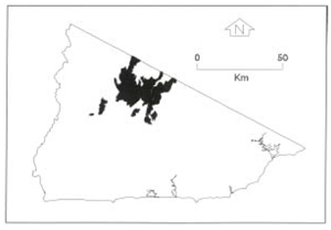 |
Soils: Dominant: Gn3.11, Gn4.11, Gn3.71, Gn4.31. These soils are friable, organic, moderately to strongly structured, moderately deep to deep, acidic, often stony red or brown gradational profiles (loam A horizons and (silty) clay loam /light clay loam B horizons). Stone content is often dependent on topographic position, aspect and lithology. These soils are leached and have high infiltration capacities despite heavier textures down the profile.
Minor: Gn4.31, Gn4.51 Drier sites, occasionally hardsetting e.g. on ridge tops etc. Minor occurrences of Duplex (yellow, brown) profiles and Uniform fluvial deposits (Um); organic loam.
Native vegetation: Very tall Wet Sclerophyll Forest is dominant with associated Cool Temperate Rainforest; Shining Gum, Mountain Grey Gum, Narrow-leaved Peppermint, Brown-barrel, Messmate Stringybark, Blackwood, Silver Wattle, Southern Sassafras, Blanket-leaf, Smooth Tree-Fern and Rough Tree-Fern. Montane Forest, Montane Sclerophyll Woodland, Snow Gum Woodland and Alpine Wet Heathland are also present Delegate River; Snow Gum, Alpine Ash, Broad-leaved Peppermint, Candlebark, Mountain Swamp Gum and Silver Wattle.
Stone/rock outcrop: Minor. Some stone particularly on upper slopes, crests.
Pans: Nil or not observed.
Land use: Predominantly forested, some natural heathland, minor clearing. A large proportion of these units lie within the Errinundra National Park. Hardwood production and grazing are other local land uses. There has been some gold mining in the past; Victoria Star mine and prospecting.
Observed land deterioration: minor sheet erosion.
Susceptibility to land deterioration: Sheet and rill erosion (low to moderate); Gully erosion (very low to moderately high); Compaction (low to high); Inundation/Waterlogging (low to moderately high); Mass movement (very low to moderately high).
Sites with laboratory data: 25, 123.
© State of Victoria (Agriculture Victoria) 1996 - .

This work, Victorian Resources Online, is licensed under a Creative Commons Attribution 4.0 licence. You are free to re-use the work under that licence, on the condition that you credit the State of Victoria (Agriculture Victoria) as author, indicate if changes were made and comply with the other licence terms.
The licence does not apply to ‘branding’ or some ‘images or photographs’ that may be owned by third parties. We ask you to seek prior approval to use images using the VRO feedback form. Access to higher quality images can also be provided on request.
This page was last updated on .