
B 3.23 Low hills, Hills and Plains, Granitic, Type 4
LuGm4, LuGh4, LurGm4, LurGh4, LurGv4, LrGm4, LrGh4, LrGv4, LHrGm4, HrGm4, HrGh4, HrGv4, HrsGm4, HsGm4, HsGh4, PlAh0, PgAh0, PuAm0, WlAv0
Soils: Dominant: Dy3.41, Dr2, Dr3.41, Dr5. Variations depend generally on topographic position, aspect and general climatic zone. The drier sites have hardsetting profiles with marked changes from sandy apedal A horizons (coarse sandy loam) which may include bleached A2 horizons to a structured clayey (sandy clay to clay with sand) B horizon which may be mottled and may have cutans present. Moister sites have less marked changes between A and B horizon with greater friability and generally more whole-coloured and redder than drier sites, for example site 199.
Minor: Multi-layered soil with recent deposits occur in some low lying areas (alluvium) with a higher organic matter content than other soils. Shallow to deep gradational profiles in some moister areas and higher topographic positions.
Native vegetation: Lowland Sclerophyll Forest occurs south of Princes Highway where there are Silvertop, White, Yellow and Brown Stringybark associations with a more coastal understorey (heath, bracken fern and occasional banksia). Dry Sclerophyll Forest occurs further north with occurrences of Wet Sclerophyll Forest with Warm Temperate and Riparian rainforest in drainage lines and depressions.
Stone/rock outcrop: Low, outcropping on some crests and upper slopes.
Pans: Nil or not exposed.
Land use: The Low hill and Hill units are forested and generally available for hardwood production (State forest), while some of the area concerned falls within the Croajingalong National Park to the south. The Plains units are generally cleared for pasture production.
Observed land deterioration: The sandy topsoils are prone to sheet and rill erosion, particularly where vegetation cover is poor and the granitic (particularly the yellow mottled) subsoils are also prone to erosion particularly if exposed: undercutting, gullying and tunnelling.
Susceptibility to land deterioration: Sheet erosion (moderately low to high); Gully erosion (low to high); Compaction (low to high); Waterlogging (low to very high); Mass movement (low to moderately high).
Sites with laboratory data: 35, 149, 193, 199
Page top
| These units are associated with the designated Noorinbee Granodiorite; north and south of Cann River township. These units occur north to the NSW border and flank the steeper, mountain units which include Mt. Denmarsh and Mt. Kaye, and Mt. Bemm to the south. The Plains units are depositional units which have their source material from the surrounding granitic material. The soil profiles on the undulating to steep units tend to be Duplex (yellow and red), occasionally Gradational while brown Duplex/Gradational and occasional multi-layered soils are found in the depositional plains units. The vegetation varies from Lowland Sclerophyll Forest in the south to Dry and Wet Sclerophyll Forest further north with drainage lines containing Riparian, Warm Temperate and Cool Temperate Rainforest. The Plains units have generally lower susceptibility to land deterioration than the hilly granitic units, except for waterlogging. Geology: Dgl4; Devonian Granodiorite (Noorinbee Granodiorite). Rainfall: 700-1200 mm per annum, generally less than 1000 mm per annum. Slope: 0-56%, generally 10-32%. Dominant landform element: Slope (lower and upper), plains (including terraces). Minor landform element: | 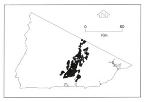 |
Soils: Dominant: Dy3.41, Dr2, Dr3.41, Dr5. Variations depend generally on topographic position, aspect and general climatic zone. The drier sites have hardsetting profiles with marked changes from sandy apedal A horizons (coarse sandy loam) which may include bleached A2 horizons to a structured clayey (sandy clay to clay with sand) B horizon which may be mottled and may have cutans present. Moister sites have less marked changes between A and B horizon with greater friability and generally more whole-coloured and redder than drier sites, for example site 199.
Minor: Multi-layered soil with recent deposits occur in some low lying areas (alluvium) with a higher organic matter content than other soils. Shallow to deep gradational profiles in some moister areas and higher topographic positions.
Native vegetation: Lowland Sclerophyll Forest occurs south of Princes Highway where there are Silvertop, White, Yellow and Brown Stringybark associations with a more coastal understorey (heath, bracken fern and occasional banksia). Dry Sclerophyll Forest occurs further north with occurrences of Wet Sclerophyll Forest with Warm Temperate and Riparian rainforest in drainage lines and depressions.
Stone/rock outcrop: Low, outcropping on some crests and upper slopes.
Pans: Nil or not exposed.
Land use: The Low hill and Hill units are forested and generally available for hardwood production (State forest), while some of the area concerned falls within the Croajingalong National Park to the south. The Plains units are generally cleared for pasture production.
Observed land deterioration: The sandy topsoils are prone to sheet and rill erosion, particularly where vegetation cover is poor and the granitic (particularly the yellow mottled) subsoils are also prone to erosion particularly if exposed: undercutting, gullying and tunnelling.
Susceptibility to land deterioration: Sheet erosion (moderately low to high); Gully erosion (low to high); Compaction (low to high); Waterlogging (low to very high); Mass movement (low to moderately high).
Sites with laboratory data: 35, 149, 193, 199
© State of Victoria (Agriculture Victoria) 1996 - .

This work, Victorian Resources Online, is licensed under a Creative Commons Attribution 4.0 licence. You are free to re-use the work under that licence, on the condition that you credit the State of Victoria (Agriculture Victoria) as author, indicate if changes were made and comply with the other licence terms.
The licence does not apply to ‘branding’ or some ‘images or photographs’ that may be owned by third parties. We ask you to seek prior approval to use images using the VRO feedback form. Access to higher quality images can also be provided on request.
This page was last updated on .