
B 3.2 Coastal Flats, Unconsolidated Sediments, Type 1
ClKm-1, ClKFm-1, CgFm-1, CgFKm-1, CgKFm-1
Soils: Dominant: Uniform coarse (occasionally duplex). Apedal yellow/grey sandy profile, neutral to alkaline pH. Minor: Duplex soils (Dy).
Native vegetation: Saline tolerant herbs, rushes and shrubs, some shrubs and trees: Swamp Paperbark (Melaleuca ericifolia), Southern Mahogany (E. botryoides), Coast Banksia ( Banksia integrifolia) and Saw Banksia (Banksia serrata).
Stone/rock outcrop: Nil.
Pans: Generally no pans. Occasional weak pan or segregation horizon on higher ground.
Land use: Some grazing, occasionally improved on freehold. Conservation and recreation in Croajingalong National Park.
Observed land deterioration: Generally low, some sheet and bank erosion depending on topographic position, and wind erosion if exposed.
Susceptibility to land deterioration: Sheet and rill erosion (low to moderate); Gully (low to moderate); Compaction (low to moderately low); Mass movement (low); Wind erosion (low to high); Bank erosion (low to moderate).
Sites with laboratory data: Nil
Page top
| Depositional low lying (occasionally inter-tidal) coarse sediments, occasionally with some fine sediments, located at estuaries and behind dune formations. The soils are generally poorly developed on unconsolidated sediments, with occasional deeper organic A horizons. The coastal vegetation ranges from saline tolerant herbs to shrubs and small trees such as Bloodwood and Swamp Paperbark depending on topographic position. The main occurrences of these units are at the estuaries of the major rivers. Geology: Qra; Quaternary alluvium/swamp deposits, unconsolidated. Rainfall: 700-1000 mm per annum. Slope: Range 0-10%, generally 0-3%. Dominant landform element: Flat. Minor landform element: Slope concave/convex, streamlet. | 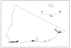 |
Soils: Dominant: Uniform coarse (occasionally duplex). Apedal yellow/grey sandy profile, neutral to alkaline pH. Minor: Duplex soils (Dy).
Native vegetation: Saline tolerant herbs, rushes and shrubs, some shrubs and trees: Swamp Paperbark (Melaleuca ericifolia), Southern Mahogany (E. botryoides), Coast Banksia ( Banksia integrifolia) and Saw Banksia (Banksia serrata).
Stone/rock outcrop: Nil.
Pans: Generally no pans. Occasional weak pan or segregation horizon on higher ground.
Land use: Some grazing, occasionally improved on freehold. Conservation and recreation in Croajingalong National Park.
Observed land deterioration: Generally low, some sheet and bank erosion depending on topographic position, and wind erosion if exposed.
Susceptibility to land deterioration: Sheet and rill erosion (low to moderate); Gully (low to moderate); Compaction (low to moderately low); Mass movement (low); Wind erosion (low to high); Bank erosion (low to moderate).
Sites with laboratory data: Nil
© State of Victoria (Agriculture Victoria) 1996 - .

This work, Victorian Resources Online, is licensed under a Creative Commons Attribution 4.0 licence. You are free to re-use the work under that licence, on the condition that you credit the State of Victoria (Agriculture Victoria) as author, indicate if changes were made and comply with the other licence terms.
The licence does not apply to ‘branding’ or some ‘images or photographs’ that may be owned by third parties. We ask you to seek prior approval to use images using the VRO feedback form. Access to higher quality images can also be provided on request.
This page was last updated on .