
B 3.18 Low hills and Hills, Sedimentary, Type 6
UuSm6, UdSm6, LuSh6, LuSv6, LurSm6, LrSm6, HrSm6, HrSh6, HsSm6, HsSh6, HvSm6
Soils: Dominant: Gn4.31, Gn3.71, Db2, Dr3, Dr2. Shallow, stony brown gradational profiles, hardsetting on drier sites (aspect and topographic position) with loam A horizons and silty clay to light medium clay B horizons. Soils are deeper and friable on moister sites, where soils are moderately well to strongly structured, particularly the subsoil (B horizon). Moderately deep to deep duplex profiles often stony, brown or red (loam fine sandy A horizons and silty clay B horizons), occasionally with poorly or non-structured A2 horizon and strongly structured B horizons occur where profile development is greater (lower slopes). Drier aspects can be more erosion prone.
Minor: Dy3. Profiles on northerly aspect and drier position and dependent on parent material stability. Alluvial deposition forming minor multi-layered profiles; duplex or uniform (clay loam to silty clay loam).
Native vegetation: Predominantly Dry Sclerophyll Forest with Wet Sclerophyll Forest and Riparian Forest. Stringybark associations; White Stringybark, Red Stringybark (Eucalyptus macrorhyncha), Yellow Stringybark, Brown Stringybark with Narrow-leaved Peppermint, Croajingolong Peppermint, Broad-leaved Peppermint and Shining Gum, Messmate, Manna Gum and Mountain Grey Gum in moister areas particularly drainage lines. Understorey has a generally low moisture status; Acacia spp., Cassinia spp., Austral bracken and Daviesia spp. and other herbs.
Stone/rock outcrop: Some surface stone, particularly on crests and upper slopes.
Pans: Generally nil, occasionally some minor nodule development.
Land use: Predominantly forest with some freehold around Dellicknora and Bonang. Some of these units fall within the Snowy River National Park and the Concordia Gully Reference Area.
Observed land deterioration: Sheet erosion, particularly on steeper slopes. Some batter destabilisation on less stable parent material (deep clay B and C horizons) in drier areas.
Susceptibility to land deterioration: Sheet and rill erosion (very low to high); Gully erosion (low to moderately high); Compaction (low to high - deeper duplex profiles); Inundation (very low to high); Mass movement (very low to moderate).
Sites with laboratory data: Nil
Page top
| These units are associated with Silurian and Ordovician sediments, east of the Bonang Highway on the plateau surface or the dissected uplands of the Roger and Deddick River basins. Some of these units are well drained higher elevation cappings of dissected terrain (generally stony) while other units such as on the plateau have a range of topographic positions or follow valley floors. The soils tend to be shallow and stony on drier, dissected crests and slopes (gradational profiles) with deeper profiles (duplex and gradational profiles) on lower slopes and the more extensive map units. Vegetation type is predominantly Dry Sclerophyll Forest with some Wet Sclerophyll Forest and Riparian Forest, with less growth (density and height) on the more exposed and drier sites. Geology: S; Silurian. Quartzitic sandstone, mudstone, shale. Ou; Ordovician. Black slate, phyllite, shale, sandstone, siltstone, minor schist, hornfels, contact rock, breccia, scree, quartzite. Rainfall: 700-1200 mm, generally 700-1000 mm per annum. Slope: Variable; 3-56%, generally 10-32%. Dominant landform element: Slope. Minor landform element: Crest, drainage depression. | 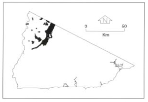 |
Soils: Dominant: Gn4.31, Gn3.71, Db2, Dr3, Dr2. Shallow, stony brown gradational profiles, hardsetting on drier sites (aspect and topographic position) with loam A horizons and silty clay to light medium clay B horizons. Soils are deeper and friable on moister sites, where soils are moderately well to strongly structured, particularly the subsoil (B horizon). Moderately deep to deep duplex profiles often stony, brown or red (loam fine sandy A horizons and silty clay B horizons), occasionally with poorly or non-structured A2 horizon and strongly structured B horizons occur where profile development is greater (lower slopes). Drier aspects can be more erosion prone.
Minor: Dy3. Profiles on northerly aspect and drier position and dependent on parent material stability. Alluvial deposition forming minor multi-layered profiles; duplex or uniform (clay loam to silty clay loam).
Native vegetation: Predominantly Dry Sclerophyll Forest with Wet Sclerophyll Forest and Riparian Forest. Stringybark associations; White Stringybark, Red Stringybark (Eucalyptus macrorhyncha), Yellow Stringybark, Brown Stringybark with Narrow-leaved Peppermint, Croajingolong Peppermint, Broad-leaved Peppermint and Shining Gum, Messmate, Manna Gum and Mountain Grey Gum in moister areas particularly drainage lines. Understorey has a generally low moisture status; Acacia spp., Cassinia spp., Austral bracken and Daviesia spp. and other herbs.
Stone/rock outcrop: Some surface stone, particularly on crests and upper slopes.
Pans: Generally nil, occasionally some minor nodule development.
Land use: Predominantly forest with some freehold around Dellicknora and Bonang. Some of these units fall within the Snowy River National Park and the Concordia Gully Reference Area.
Observed land deterioration: Sheet erosion, particularly on steeper slopes. Some batter destabilisation on less stable parent material (deep clay B and C horizons) in drier areas.
Susceptibility to land deterioration: Sheet and rill erosion (very low to high); Gully erosion (low to moderately high); Compaction (low to high - deeper duplex profiles); Inundation (very low to high); Mass movement (very low to moderate).
Sites with laboratory data: Nil
© State of Victoria (Agriculture Victoria) 1996 - .

This work, Victorian Resources Online, is licensed under a Creative Commons Attribution 4.0 licence. You are free to re-use the work under that licence, on the condition that you credit the State of Victoria (Agriculture Victoria) as author, indicate if changes were made and comply with the other licence terms.
The licence does not apply to ‘branding’ or some ‘images or photographs’ that may be owned by third parties. We ask you to seek prior approval to use images using the VRO feedback form. Access to higher quality images can also be provided on request.
This page was last updated on .