B 3.16 Low hills and Hills, Sedimentary, Type 4
LurSm4, LurSh4, HrSh4, HrSv4, HsSm4, HsSh4, PuAv0
Soils: Dominant: Gn3.11, Dr, Db1.11, Db1.21. Deep red/brown gradational profile (becoming duplex) with strongly structured stony B horizons (light to medium clay) grading into weathered parent material with occasional minor mottling. The A horizons can be hardsetting with massive or weakly structured A12/A2 horizons (sandy/silty loam to silty clay loam). Low to moderate organic matter content especially in drier areas.
Minor: Um, Db, Dr profiles. Terrace and floodplain soils may have greater organic matter (surface horizons) and variable stone content with a high silt/fine sand component.
Native vegetation: Predominantly Dry Sclerophyll Forest with Silvertop, Narrow-leaved Peppermint (E. radiata), White Stringybark, Yellow Stringybark with other Stringybarks depending on moisture status, aspect and position. Some gums such as Mountain Grey Gum and Manna Gum occur in moister areas; Wet Sclerophyll Forest and Riparian Vegetation. Understorey consists of shrubs and herbs (e.g. Bitter-pea spp., low Acacia spp.) in Dry Sclerophyll Forest. Pasture has replaced the native vegetation on the valley floodplain, terraces and some lower slopes.
Stone/rock outcrop: Moderate (stone); mainly crest, upper and mid slopes.
Pans: Nil or not observed.
Land use: About 75% of these units are forested and designated State Forest and therefore available for hardwood timber production. There is a substantial area of freehold some of which is forested but much of it cleared for pasture, particularly around the major drainage line.
Observed land deterioration: Sheet and rill erosion, gully and bank erosion associated with road construction.
Susceptibility to land deterioration: Sheet and rill erosion (low to high); Gully erosion (low to high); Compaction (moderate to high); Bank (including batter) erosion (moderate to high); Mass movement (very low to moderately high). A.5.7
Sites with laboratory data: 31, 38.
Page top
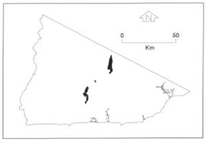
| This small group of units consists of undulating, rolling and steep terrain on Devonian sediments, similar to Type 3 sediments. However the Type 4 sediments are generally finer than Type 3 units. The Type 4 units are located around the Buldah Valley (lower rainfall than surrounding area) and extend south; east of The Three Sisters. The soils range from shallow stony gradational profiles on upper and mid-slope, steep slopes to red duplex and gradational soils on lower slopes depending on moisture status and duplex, multi-layered and uniform profiles on terraces and valley floors. The vegetation is mainly Dry Sclerophyll forest with some Wet Sclerophyll Forest and Riparian forest in moister areas and aspects and in drainage lines. Some lower slopes, terraces and floodplain have been cleared. Geology: Duc; Devonian sediments (Cann River Beds). Sandstone, siltstone, mudstone, shale, "red beds", conglomerate. Rainfall: 700-1200 mm per annum, generally 700-1000 mm per annum. Slope: Variable; 3-56%. Dominant landform element: Slope, terrace, floodplain. Minor landform element: Drainage depression. |  |
Soils: Dominant: Gn3.11, Dr, Db1.11, Db1.21. Deep red/brown gradational profile (becoming duplex) with strongly structured stony B horizons (light to medium clay) grading into weathered parent material with occasional minor mottling. The A horizons can be hardsetting with massive or weakly structured A12/A2 horizons (sandy/silty loam to silty clay loam). Low to moderate organic matter content especially in drier areas.
Minor: Um, Db, Dr profiles. Terrace and floodplain soils may have greater organic matter (surface horizons) and variable stone content with a high silt/fine sand component.
Native vegetation: Predominantly Dry Sclerophyll Forest with Silvertop, Narrow-leaved Peppermint (E. radiata), White Stringybark, Yellow Stringybark with other Stringybarks depending on moisture status, aspect and position. Some gums such as Mountain Grey Gum and Manna Gum occur in moister areas; Wet Sclerophyll Forest and Riparian Vegetation. Understorey consists of shrubs and herbs (e.g. Bitter-pea spp., low Acacia spp.) in Dry Sclerophyll Forest. Pasture has replaced the native vegetation on the valley floodplain, terraces and some lower slopes.
Stone/rock outcrop: Moderate (stone); mainly crest, upper and mid slopes.
Pans: Nil or not observed.
Land use: About 75% of these units are forested and designated State Forest and therefore available for hardwood timber production. There is a substantial area of freehold some of which is forested but much of it cleared for pasture, particularly around the major drainage line.
Observed land deterioration: Sheet and rill erosion, gully and bank erosion associated with road construction.
Susceptibility to land deterioration: Sheet and rill erosion (low to high); Gully erosion (low to high); Compaction (moderate to high); Bank (including batter) erosion (moderate to high); Mass movement (very low to moderately high). A.5.7
Sites with laboratory data: 31, 38.


