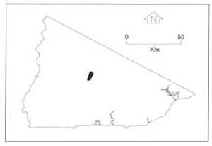
B 3.12 Low hills, Hills, Granitic, Type 6
HrGv6
Native vegetation: The vegetation consists of Wet and Dry Sclerophyll Forest, generally Stringybark associations Yellow, Brown and White Stringybark with Messmate, Mountain Grey Gum, Manna Gum or River Peppermint (E. elata) in and around drainage lines with a sparse understorey on steeper, drier slopes and aspects.
Stone/rock outcrop: Minor, due to topographic position, mid-slope interfluves have occasional outcrops and stonier surfaces.
Pans: Nil.
Land use: Predominantly forested, some of the unit is within the Errinundra National Park the rest being State Forest and therefore available for timber harvesting. Approximately 20% of the unit is cleared and has been used for grazing; a land use that requires low management input.
Observed land deterioration: Sheet and rill erosion. Some bank and minor gully erosion associated with drainage lines.
Susceptibility to land deterioration: Sheet and rill erosion (moderately low to high); Gully erosion (moderately low to high); Compaction (low to moderately high); Stream Bank erosion (moderate); Inundation (low); Mass movement (low to moderate).
Sites with laboratory data: Nil.
Page top
| This unit primarily consists of the upper Errinundra Valley with a large area of low relief but the overall relief of the unit necessitates a Hill classification. This unit is at the foot of the Errinundra Plateau encompassing the lower Ada River area, Errinundra Freehold and north to Snake Creek. Geologically this area is part of the Ellery Granodiorite pluton. The soils range from shallow to deep gradational profiles on weathered parent material on lower slopes to deep uniform and multi-layered profiles on the valley floor. The vegetation is predominantly Wet Sclerophyll Forest with Messmate (Eucalyptus obliqua) and Mountain Grey Gum. About 20% of the units are cleared freehold at Errinundra. Geology: Dgl6; Devonian Granodiorite (Ellery Granodiorite). Rainfall: Greater than 1200 mm per annum. Slope: 3-32%, predominantly 10-32%. Dominant landform element: Slope (lower and middle). Minor landform element: Terraces, flood plain. |  |
Soils
: Dominant: Gn3.11, Gn3.71. Um5.51, Um6.21 Gradational, profile predominantly an A/C profile depending on weathered nature of parent rock, and topographic position. Brown to dark friable organic sandy loam A horizon. Weakly structured, the A horizon clearly overlies weathered parent material (C horizon) at between 30 and 40 cm depth. A red friable gradational profile also appears on some lower, colluvial slope (southerly aspect) with a strongly structured clayey (sandy clay to gritty medium clay) B horizon (deep) which is overlain by a friable, earthy moderately structured organic A horizon (35 cm depth).Native vegetation: The vegetation consists of Wet and Dry Sclerophyll Forest, generally Stringybark associations Yellow, Brown and White Stringybark with Messmate, Mountain Grey Gum, Manna Gum or River Peppermint (E. elata) in and around drainage lines with a sparse understorey on steeper, drier slopes and aspects.
Stone/rock outcrop: Minor, due to topographic position, mid-slope interfluves have occasional outcrops and stonier surfaces.
Pans: Nil.
Land use: Predominantly forested, some of the unit is within the Errinundra National Park the rest being State Forest and therefore available for timber harvesting. Approximately 20% of the unit is cleared and has been used for grazing; a land use that requires low management input.
Observed land deterioration: Sheet and rill erosion. Some bank and minor gully erosion associated with drainage lines.
Susceptibility to land deterioration: Sheet and rill erosion (moderately low to high); Gully erosion (moderately low to high); Compaction (low to moderately high); Stream Bank erosion (moderate); Inundation (low); Mass movement (low to moderate).
Sites with laboratory data: Nil.


