
B 3.11 Low hills, Hills, Granitic, Type 5
LuGKm5, LrGm5, HrsGh5, HsGm5, HsGh5
Soils: Dominant: Dy3.11, Dy3.21, Dy3.22, Dy3.41, Dy3.42. Duplex profiles (A/C horizons) occur on steeper slopes consisting of an organic structured A horizon (sandy loam) overlying weathered parent material overlying solid rock. Duplex profiles on gentler, lower slopes have sandy A horizons (sandy loam) which clearly overlie structured yellow mottled clay (sandy clay loams to medium clay with sand) B horizon. Soil profile depths ranged from moderately deep to deep.
Minor: Shallow Gradational (Gn4, Gn2) and Uniform profiles around crests and upper slopes: high coarse sand component.
Native vegetation: Dry Sclerophyll Forest type with some Riparian Rainforest in depressions and drainage lines. Forest structure is often more open than on other non-granitic parent materials with a low understorey. Gums may be more apparent again depending on topographic position.
Stone/rock outcrop: Confined to crest and upper slopes, particularly around Murrungowar.
Land use: Although much of the Murrungowar area has been cleared for grazing, elsewhere these map units are forested and available for hardwood production.
Observed land deterioration: Sheet erosion, some undercutting and tunnelling where exposed particularly on lower slopes.
Susceptibility to land deterioration: Sheet and rill erosion (moderate to very high); Gully erosion (moderate to high); Compaction (low to moderately high); Mass movement (low to moderately high).
Sites with laboratory data: Nil.
Page top
| These units cover an outcrop of granitic material outcropping around Murrungowar, much smaller than most of the other granitic plutons in the study area. The soils vary from less developed profiles on the steeper terrain to deep yellow/brown duplex profiles on the gentler (particularly lower) slopes. The vegetation tends to be more open on the granitic terrain, generally Dry Sclerophyll Forest with some moister sites such as drainage lines having Riparian or Warm Temperate Rainforest. Geology: Dgl5; Devonian Granodiorite (Murrungowar Granodiorite) Rainfall: 700-1200 mm per annum, generally 1000 to 1200 mm per annum. Slope: 10-56%, generally 32-56%. Dominant landform element: Slope. Minor landform element: | 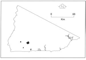 |
Soils: Dominant: Dy3.11, Dy3.21, Dy3.22, Dy3.41, Dy3.42. Duplex profiles (A/C horizons) occur on steeper slopes consisting of an organic structured A horizon (sandy loam) overlying weathered parent material overlying solid rock. Duplex profiles on gentler, lower slopes have sandy A horizons (sandy loam) which clearly overlie structured yellow mottled clay (sandy clay loams to medium clay with sand) B horizon. Soil profile depths ranged from moderately deep to deep.
Minor: Shallow Gradational (Gn4, Gn2) and Uniform profiles around crests and upper slopes: high coarse sand component.
Native vegetation: Dry Sclerophyll Forest type with some Riparian Rainforest in depressions and drainage lines. Forest structure is often more open than on other non-granitic parent materials with a low understorey. Gums may be more apparent again depending on topographic position.
Stone/rock outcrop: Confined to crest and upper slopes, particularly around Murrungowar.
Land use: Although much of the Murrungowar area has been cleared for grazing, elsewhere these map units are forested and available for hardwood production.
Observed land deterioration: Sheet erosion, some undercutting and tunnelling where exposed particularly on lower slopes.
Susceptibility to land deterioration: Sheet and rill erosion (moderate to very high); Gully erosion (moderate to high); Compaction (low to moderately high); Mass movement (low to moderately high).
Sites with laboratory data: Nil.
© State of Victoria (Agriculture Victoria) 1996 - .

This work, Victorian Resources Online, is licensed under a Creative Commons Attribution 4.0 licence. You are free to re-use the work under that licence, on the condition that you credit the State of Victoria (Agriculture Victoria) as author, indicate if changes were made and comply with the other licence terms.
The licence does not apply to ‘branding’ or some ‘images or photographs’ that may be owned by third parties. We ask you to seek prior approval to use images using the VRO feedback form. Access to higher quality images can also be provided on request.
This page was last updated on .