
B 3.1 Dunes, Coarse Unconsolidated, Type 1
DuKm-1, DuKh-1, DurKm-1, DrKm-1, DrKh-1, DrsKm-1, DRuKm-1
| These are coastal dune units with designated slope categories that have formed along a large proportion of the coast in the study area. There are occasional swales interposed between the dunes but the units are generally well to excessively drained because of the sandy parent material. The soils are typically uniform with greater organic matter content in the surface (A) horizon. Generally the soils have two distinct horizons - the upper being a pale to grey sand, depending on organic matter content while the lower horizon is a yellow sand occasionally with some nodule in the upper portion. These horizons are often separated by a dark brown humic pan, which has variable permeability. The vegetation is of the coastal type, with a greater number of Bloodwood trees in sheltered areas east of Wingan Inlet. Aspect and position (ie. exposure to prevailing winds) are important factors in coastal vegetation development. Geology: Qrp; Quaternary windblown deposits. Dunes, beach deposits. Rainfall: 700-1000 mm per annum. Slope: Variable: Range 3-100%, generally 32-56%. Dominant landform element: Slope. Minor landform element: Closed depression (swale). | 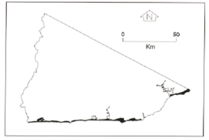 |
Soils: Dominant: Deep (1.0 m+) Uc, Uniform coarse sand soils with an organic surface horizon, unconsolidated grey sand over a humic layer (of variable thickness depending on topographic position) overlying a yellow sand deposit with some nodules (silcrete) in the upper portion. Tenosols
Minor: Dy Sandy duplex soils with organic dominant A horizons. Portasols
Native vegetation: The vegetation is dominated by climatic conditions. Low trees (often stunted) such as Silver-leafed Stringybark (Eucalyptus cephalocarpa) and Red Bloodwood (E. gummifera) with smaller shrubs and grasses particularly Marram Grass (Ammophila arenaria). Sedges and rushes are present in some depressions.
Stone/rock outcrop: Nil.
Pans: Weakly to strongly cemented humic sandy pan generally 0.5 - 1.2 m below the soil surface.
Land use: Predominantly native vegetation often within the Croajingalong National Park: conservation and recreation.
Observed land deterioration: Generally low, however there are active dunes along the coast particularly at Point Hicks and Cape Howe. Walking trails have been badly eroded in some places.
Susceptibility to land deterioration: Sheet erosion (low-high); Gully erosion (low); Waterlogging (low, to moderate in depressions); Wind erosion (high); Salting (low-high).
Sites with laboratory data: Nil
© State of Victoria (Agriculture Victoria) 1996 - .

This work, Victorian Resources Online, is licensed under a Creative Commons Attribution 4.0 licence. You are free to re-use the work under that licence, on the condition that you credit the State of Victoria (Agriculture Victoria) as author, indicate if changes were made and comply with the other licence terms.
The licence does not apply to ‘branding’ or some ‘images or photographs’ that may be owned by third parties. We ask you to seek prior approval to use images using the VRO feedback form. Access to higher quality images can also be provided on request.
This page was last updated on .