
Soil/Landform Unit 24
Landform Unit Description
Page top
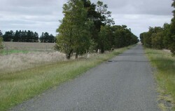 Undulating in the plain denoting the relatively subdued nature of this sedimentary landform |
0.01% of CMA region The unit consists of gently undulating plains that occur west of Meredith. The broad rounded topography is in association with a Neogene capping of sands and other unconsolidated sediments. These plains comprise long gentle slopes with neutral mottled yellow and brown texture contrast soils and minor alkaline equivalents. Remnant vegetation includes Eucalyptus ovata, E. viminalis, E. rubida and E. obliqua of the Plains Grassy Woodlands. The slopes and depressions are mainly used for sheep and cattle grazing. While there may be minor cropping, hardsetting surfaces combined with slowly permeable subsoils often result in soil waterlogging. This is a major limitation to support a wide variety of land uses. Topsoils have a moderate to high water holding capacity where they are deep. |  |
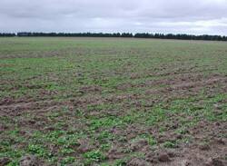 Cropping and fodder crops are main land uses with grazing of this unit | 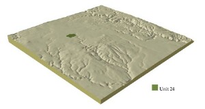 |
| 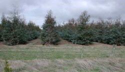 Blue gum plantation on the soutnern boundary of this unit |
Component | 1 | 2 | 3 |
Proportion of soil-landform unit | 95% | 3% | 2% |
| CLIMATE Rainfall (mm) | Annual: 700 | ||
| Temperature (oC) | Minimujm 7, Maximum 18 | ||
| Precipitation less than potential evapotranspiration | October-March | ||
| GEOLOGY Age and lithology | Neogene sediments | ||
| Geomorphology | |||
| LANDUSE | Uncleared: Nature conservation Cleared: Grazing; occasional cropping (cereal) | ||
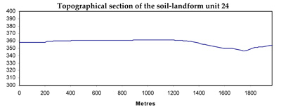
| TOPOGRAPHY Landscape | Gently undulating plains | ||
| Elevation range (m) | 348-364 | ||
| Local relief (m) | 2 | ||
| Drainage pattern | Dendritic | ||
| Drainage density (km/km2) | 0.6 | ||
| Landform | Depressions | ||
| Landform element | Long gentle upper slopes | Depression | Crest |
| Slope and range (%) | 1 (1-3) | 1 (1-2) | 3 (2-5) |
| Slope shape | Straight | Straight | Convex |
| NATIVE VEGETATION Ecological Vegetation Class | Plains Grassy Woodland (0.2%) | ||
| Dominant species | E. ovata, E. viminalis, E. rubida, E. obliqua | ||
| SOIL Parent material | Unconsolidated gravel, sand and clay | Unconsolidated gravel, sand and clay | Unconsolidated gravel, sand and clay |
| Description (Corangamite Soil Group) | Red mottled, brown, grey or yellow texture contrast soil, fine structure (15) | Black cracking lcay soil, coarse structure (31) | Red mottled, brown, grey or yellow texture contrast soil, fine structure (15) |
| Soil type sites | |||
| Surface texture | Sandy clay loam to loamy sand | Clay | Sandy clay loam to loamy sand |
| Permeability | Moderate | Moderate | Moderate |
| Depth (m) | 2 | 1.5 | 2 |
| LAND CHARACTERISTICS, POTENTIAL AND LIMITATIONS | Hardsetting surfaces and slowly permeable subsoils often result in overland flow. Soil compaction and sheet erosion are also degradational limitations. | Hardsetting surfaces and slowly permeable subsoils often result in overland flow. Periodic waterlogging occurs in wet seasons. Soil compaction, streambank undercutting and streambank erosion are degradational issues. | Hardsetting surfaces and slowly permeable subsoils often results in overland flow. Soil compaction, sheet erosion and nutrient decline are also degradational issues. |
© State of Victoria (Agriculture Victoria) 1996 - .

This work, Victorian Resources Online, is licensed under a Creative Commons Attribution 4.0 licence. You are free to re-use the work under that licence, on the condition that you credit the State of Victoria (Agriculture Victoria) as author, indicate if changes were made and comply with the other licence terms.
The licence does not apply to ‘branding’ or some ‘images or photographs’ that may be owned by third parties. We ask you to seek prior approval to use images using the VRO feedback form. Access to higher quality images can also be provided on request.
This page was last updated on .