
10. Coastal Sections at Quine’s Creek
This information has been developed from the publication:
|
| Location | 245063; 242060. Cliffed sections adjacent to mouth of Quine's Creek at the head of Shallow Inlet. |
Access: | Boat to head of inlet or walk from Adams Road. |
Significant Features: | Cliffs 2 to 3 m high lie along the northern margin of Shallow Inlet. The cliff are the eroding margin of a very level plain with a surface less than 10 metres below present sea level that surrounds the head of Shallow Inlet. The cliffs expose a complex stratigraphy of lagoonal deposits including sandy clays, organic (fibrous) clays and hard cracking clays. Smith (1969) interpreted these to be deposits on the floor of a Pleistocene lagoon formed when sea level reach 5 to 7 m above the present. At the base of the higher cliffs is a remnant narrow terrace of salt marsh peat and clay 0.5 m above high water level. The edge of this terrace is eroding and there is no salt marsh remaining. |
Significance Level: | Regional. The cliff material provides evidence of the Pleistocene environment of Shallow Inlet and is important in determining the Late Quaternary evolution of the inlet. The absence of salt marsh today, compared with the presence of the salt marsh peat terrace, indicates greater exposure or reduced tidal levels at the head of the inlet. |
Management Issues: | Cliff erosion may threaten private property and there will be pressure for protective walls. Exclusion of grazing from the inlet edge may reduce erosion rates marginally but in the long term it may be necessary to acquire buffer strips along the coastline. Increased erosion will increase the muddiness of Shallow Inlet and the possibility of introducing saltmarsh plants to protect the cliffs needs to be evaluated. |
Research & Monitoring Requirements: | Establishment of survey lines to monitor rates of cliff erosion. |
Public Interpretation Possibilities: | This part of the inlet is difficult to access due to the deep drains and creek channels. Bridging of these to allow a ‘round the inlet’ foot traverse should be investigated. Such a traverse would make accessible sites now very difficult to observe which would be of interest naturalist groups. |
Main Reference: | Smith, A. S. (1969). 'The geomorphology of Shallow Inlet, Victoria.' B.Sc. (Hons) Thesis. Dept. of Geography. Univ. of Melb. |
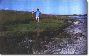 Eroding salt marsh peat terrace near Quine's Creek | 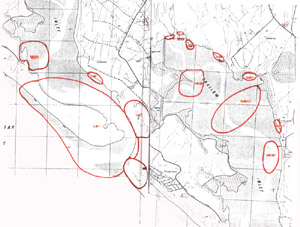 Shallow Inlet (south and north) |
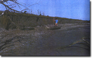 Pleistocene lagoonal deposits - north-west shore of Shallow Inlet | 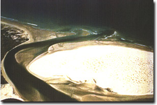 Eroding low salt marsh terrace between Quines Creek and Dividing Creek at the head of Shallow Inlet |
© State of Victoria (Agriculture Victoria) 1996 - .

This work, Victorian Resources Online, is licensed under a Creative Commons Attribution 4.0 licence. You are free to re-use the work under that licence, on the condition that you credit the State of Victoria (Agriculture Victoria) as author, indicate if changes were made and comply with the other licence terms.
The licence does not apply to ‘branding’ or some ‘images or photographs’ that may be owned by third parties. We ask you to seek prior approval to use images using the VRO feedback form. Access to higher quality images can also be provided on request.
This page was last updated on .