
7.2.2 Prior stream plains (Agnes, Yarram, Yinnar, Tinamba, Clydebank)
7. Eastern Plains (EP)
7.2 South eastern Riverine Plains
| The prior stream plains are higher in elevation than the present flood plains and are on alluvium deposited by meandering streams that were active prior to the Last Glacial period. As these streams flooded, natural levees were formed on either side of the streambeds, with back swamps and flood plains further away. In places these levees are often recognisable as they form sinuous ridges above the general level of the plains. One such stream backed up behind Snake Ridge between Rosedale and Sale before it finally broke through to the south; forming what is known as the Kilmany Gap. Other examples of leveed stream systems are clearly evident around Sale, Tinamba, Clydebank, Yarram and Yinnar, Similar stream channels in the Northern Riverine Plains are also referred to as prior streams (Butler, 1950). In the Maffra-Sale district the soils on the levees are reasonably permeable red texture contrast soils (Sodosols or Chromosols), but on the flatter areas they are less permeable and sodic yellow and brown texture contrast soils (Sodosols). Some dark grey clay soils (Vertosols) occur in the former back swamps. Many of the soils around Yinnar lack texture contrast (Dermosols) and some are clay soils (Vertosols). The vegetation types vary according to rainfall; around Maffra and Sale the prior stream plains were probably plains grassland and plains grassy woodland. Wetter areas, for example near Trafalgar and Toora, supported grassy woodlands to lowland forests with areas of swamp scrub. | 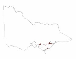 |
Almost all of the original vegetation is now cleared and the land now supports pasture. Around Maffra and Sale, where water is available from the Macalister and Thompson Rivers, these plains are easily irrigated as the land slopes from the levees towards the former flood plains.
© State of Victoria (Agriculture Victoria) 1996 - .

This work, Victorian Resources Online, is licensed under a Creative Commons Attribution 4.0 licence. You are free to re-use the work under that licence, on the condition that you credit the State of Victoria (Agriculture Victoria) as author, indicate if changes were made and comply with the other licence terms.
The licence does not apply to ‘branding’ or some ‘images or photographs’ that may be owned by third parties. We ask you to seek prior approval to use images using the VRO feedback form. Access to higher quality images can also be provided on request.
This page was last updated on .