
6.1.4 Plains with well developed drainage and deep regolith (Cressy)
6. Western Plains (WP)
6.1 Volcanic plains
| Plains with well developed drainage represent the earlier Pliocene volcanic landscapes, from five million to two million years ago (mya), and are transitional to geomorphological unit 6.1.3. Examples of this landform can be seen in the region north-west of Cressy and south-east of Wallinduc, and drainage is well established and ephemeral wetlands are relatively few. These areas are characterised by very planar landscapes with thicker soil development. Regolith profiles on these old basaltic lavas have developed many metres of pallid kaolinitic clay, with ironstone at shallow depth. Associated soil types are predominantly black and brown sodic mottled texture contrast soils (Sodosols). Scattered Red Gum cover is characteristic, and the areas of this unit are charactteristically plateaus, with deep valleys incised at their margins. | 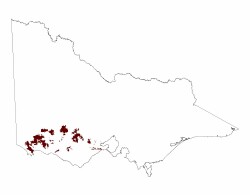 |
Towards the Western Uplands to the north, for example south of Rokewood, these lava plains are covered by a thin veneer of sandy and silty outwash deposits.
The regolith and associated soils of unit 6.1.4 have been described as the Hamilton Regolith Landform Unit of Gibbons & Gill 1964, and Joyce 1999.
© State of Victoria (Agriculture Victoria) 1996 - .

This work, Victorian Resources Online, is licensed under a Creative Commons Attribution 4.0 licence. You are free to re-use the work under that licence, on the condition that you credit the State of Victoria (Agriculture Victoria) as author, indicate if changes were made and comply with the other licence terms.
The licence does not apply to ‘branding’ or some ‘images or photographs’ that may be owned by third parties. We ask you to seek prior approval to use images using the VRO feedback form. Access to higher quality images can also be provided on request.
This page was last updated on .