
2.2.3 Valleys, alluvial terraces and floodplains (Victoria Valley)
2. Western Uplands (WU)
2.2 Strike ridges and valleys - Grampians Range
| Extensive and broad zones of outwash sands surround the prominent strike ridges of the Grampian Ranges. Examples include outwash slopes along the eastern fringe of the Grampians Ranges – e.g. Pomonal area, western Black Range and Fyans Creek Valley. These depositional landscapes are dominated by landforms including alluvial fans, sand plains and tributaries of major drainage networks within and surrounding the ranges (e.g. Mount William Creek, Wannon River, and Glenelg River). Outwash slopes of sand sheets have maximum gradients of 5 percent that tend to level out towards alluvial flats and drainage lines below the ranges. Relief is generally 30 m or less (Ollier & Joyce 1986) over long gentle slopes with the number of depositional layers and depth of these deposits varied. Terraces and floodplains are found along valleys within the confines of the Grampians Ranges (Hills 1936). Streams are unidirectional flowing away from the prominent strike ridges of the Grampians and Black ranges, often converging as tributaries into significant waterways of the catchment as creeks and rivers of floodplains and alluvial plains. Lake Belfield in the Fyans Creek Valley is an example of a dam that has harnessed the significant volumes of water shed by the ranges and slopes into this significant water supply. | 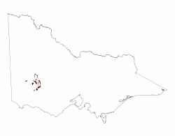 |
Sandy deposits of these colluvial valleys, alluvial terraces and floodplains are often quite deep and extensive, overlying deeply weathered members of the Grampians Group. Deposits are typically composed of sandstone pebbles in a matrix of sand or clay. Colluvial fans surrounding the Grampians ranges are thick (20–50 m in places) with some of the deposits no longer active due to the regulation of stream flows and development of Lake Belfield. The alluvial fan debouching from Halls Gap is an example of this where sands, silts and clays form a thin veneer (Cayley & Taylor 2001). High concentrations of organic matter are prevalent especially in the Fyans Creek Valley where high rainfall combined with low exposure to northerly and westerly winds preserves moist environments responsible for these deposits.
Sands are prominent throughout soils of these landforms with brown and yellow texture contrast soils common. Profiles with deep sands (Podosols, Kandosols) or without pans (Tenosols) also occur along with cracking clays (Vertosols) in lower depressions.
The texture contrast soils occur with sandy topsoil over strongly mottled clayey subsoil which may be slightly acidic (Kurosols) or occasionally sodic (Sodosols). Depth of these profiles is generally greater than 100 cm.
Vegetation is typically sandy to wet heathlands/woodlands and short dry sclerophyll forest (Heathy Dry Forest) that intermingle on outwash slopes, with woodlands predominating on the wetter middle and lower positions and forests on drier upper positions (Sibley 1967). Messmate, Brown Stringybark, Apple Box and Peppermint are common with Long Leaf Box found occasionally on uppermost slopes. Heathy understorey occurs in scattered areas where waterlogging is evident.
© State of Victoria (Agriculture Victoria) 1996 - .

This work, Victorian Resources Online, is licensed under a Creative Commons Attribution 4.0 licence. You are free to re-use the work under that licence, on the condition that you credit the State of Victoria (Agriculture Victoria) as author, indicate if changes were made and comply with the other licence terms.
The licence does not apply to ‘branding’ or some ‘images or photographs’ that may be owned by third parties. We ask you to seek prior approval to use images using the VRO feedback form. Access to higher quality images can also be provided on request.
This page was last updated on .