
B 3.34 Mountains and Escarpments, Sedimentary, Type 6
MrSm6, MrSh6, MrsSm6, MsSd6, MsSm6, MsSh6, MvsSm6, MvSd6, MvSm6, MvSh6, SMvSm6, SsvSh6, SsvSv6, SvSd6, SvpSm6, SvSm6, SvSh6, SpSm6
Soils: Dominant: Gn3.11, Gn4.11, Gn3.71, Gn4.31, Um. Shallow to moderately deep, stony, friable gradational and uniform profiles of fine sandy loam A horizons to silt loam/ fine sandy clay loam B horizons (greater organic matter content at moister sites). Deep, friable strongly structured red and brown gradational profiles in moister areas (moister aspects and topographic positions) with loam/silt loam A horizons to clay loam/light clay B horizons. Soils are generally acidic.
Minor: Gn4.13; Gradational profile with alkaline soil reaction trend; may be Gc where localised limestone is the parent material. Duplex profiles (Dy3) on drier lower slopes which may have accumulated (colluvial) material. Multi-layered or uniform soil profiles on recently deposited material in drainage lines.
Native vegetation: Variable vegetation associations with subalpine grasslands/rocky areas and montane forest; Snow Gum, Tingaringy Gum (E. glaucesens, E. saxitilis) at higher elevations (Mt. Tingaringy). Wet Sclerophyll Forest, Dry Sclerophyll Forest and Riparian Forest; Shining Gum, Mountain Ash, Mountain Grey Gum, Messmate, Stringybark associations; Red Stringybark, Yellow Stringybark, Brown Stringybark and Silvertop. Rain-Shadow Woodland; White Box, White Cyprus Pine and Blakely's Red Gum. Associated understorey for forest canopies; Acacia spp., Pomaderris spp, Cassinia spp. Smooth Tree-Fern, Pea spp, Geebung spp. and other herbs.
Stone/rock outcrop: Moderate to high stone content on the steeper dissected country with exposed rock on crests and upper slope e.g. Mt. Tingaringy, western rock face.
Pans: Nil or not observed.
Land use: Predominantly forest with most of these map units within the Snowy River and Tingaringy National Parks.
Observed land deterioration: Some sheet and rill erosion.
Susceptibility to land deterioration: Sheet and rill erosion (low to very high); Gully erosion (low to high). Compaction (low to moderately high); Streambank (low to high); Mass movement (low to high).
Sites with laboratory data: Nil.
Page top
| These units are based on Silurian and Ordovician age sediments and consist of the Yalmy Scarp, the sedimentary terrain of the Rodger River Basin and the dissected sedimentary terrain north of the Deddick River including Mt. Tingaringy, peneplains of the NSW border area and east to Dellicknora. The Mt. Tingaringy Peneplain is regarded to have more in common with the steeper surrounding terrain than the lower elevation Low hill and Hill units. These Mountain units tend to have shallow stony profiles particularly on the crests, upper slopes and mid-slopes but many have greater soil development (deeper) elsewhere. The vegetation consists of Montane Sclerophyll Woodland, Snow Gum Woodland, Montane Forest (Snow gum) at higher elevations and Dry Sclerophyll Forest, Rainforest Woodland, Wet Sclerophyll Forest, some Riparian and Cool Temperate Rainforest. Geology: S; Silurian. Quartzitic sandstone, mudstone, shale. Ou; Ordovician. Black slate, phyllite, shale, sandstone. Siltstone, minor schist, hornfels, contact rock, breccia, scree quartz. Rainfall: 700-1200 mm per annum, generally 700-1000 mm per annum. Slope: 32 - greater than 100%, generally 32-56%. Dominant landform element: Slope. Minor landform element: Peneplain, drainage depression. | 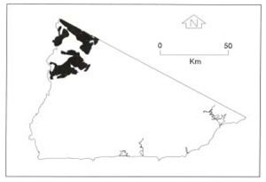 |
Soils: Dominant: Gn3.11, Gn4.11, Gn3.71, Gn4.31, Um. Shallow to moderately deep, stony, friable gradational and uniform profiles of fine sandy loam A horizons to silt loam/ fine sandy clay loam B horizons (greater organic matter content at moister sites). Deep, friable strongly structured red and brown gradational profiles in moister areas (moister aspects and topographic positions) with loam/silt loam A horizons to clay loam/light clay B horizons. Soils are generally acidic.
Minor: Gn4.13; Gradational profile with alkaline soil reaction trend; may be Gc where localised limestone is the parent material. Duplex profiles (Dy3) on drier lower slopes which may have accumulated (colluvial) material. Multi-layered or uniform soil profiles on recently deposited material in drainage lines.
Native vegetation: Variable vegetation associations with subalpine grasslands/rocky areas and montane forest; Snow Gum, Tingaringy Gum (E. glaucesens, E. saxitilis) at higher elevations (Mt. Tingaringy). Wet Sclerophyll Forest, Dry Sclerophyll Forest and Riparian Forest; Shining Gum, Mountain Ash, Mountain Grey Gum, Messmate, Stringybark associations; Red Stringybark, Yellow Stringybark, Brown Stringybark and Silvertop. Rain-Shadow Woodland; White Box, White Cyprus Pine and Blakely's Red Gum. Associated understorey for forest canopies; Acacia spp., Pomaderris spp, Cassinia spp. Smooth Tree-Fern, Pea spp, Geebung spp. and other herbs.
Stone/rock outcrop: Moderate to high stone content on the steeper dissected country with exposed rock on crests and upper slope e.g. Mt. Tingaringy, western rock face.
Pans: Nil or not observed.
Land use: Predominantly forest with most of these map units within the Snowy River and Tingaringy National Parks.
Observed land deterioration: Some sheet and rill erosion.
Susceptibility to land deterioration: Sheet and rill erosion (low to very high); Gully erosion (low to high). Compaction (low to moderately high); Streambank (low to high); Mass movement (low to high).
Sites with laboratory data: Nil.
© State of Victoria (Agriculture Victoria) 1996 - .

This work, Victorian Resources Online, is licensed under a Creative Commons Attribution 4.0 licence. You are free to re-use the work under that licence, on the condition that you credit the State of Victoria (Agriculture Victoria) as author, indicate if changes were made and comply with the other licence terms.
The licence does not apply to ‘branding’ or some ‘images or photographs’ that may be owned by third parties. We ask you to seek prior approval to use images using the VRO feedback form. Access to higher quality images can also be provided on request.
This page was last updated on .