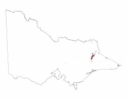
1.2.2 Enclosed landscapes of low relief (Fraser Tableland, Benambra)
1. Eastern Uplands (EU)
1.2.1 Plateaux and broad ridges (Straghbogie, Koetong-Shelly, Errinundra, Kinglake, Olinda)
1.2.2 Enclosed landscapes of low relief (Fraser Tableland, Benambra)
| The Omeo landscape (600 – 800 m) is included in this Tier of low relief although its local relief (up to 120 m) is often slightly above the defined “low” category (up to 90 m). It is a most complex area where the dominant metamorphic (gneissic) rocks are usually deeply weathered and easily eroded, and it includes the Hinnomunjie swamp north-east of Omeo resulting partly from recent fault movements. Also included is a basin eroded by the Livingstone Creek that has alluvial deposits up to 15 m thick. The Fraser Tableland area north of Benambra (about 650 m) was formed by the partial infilling of the valley of Deep Creek, and the lower reaches of Morass Creek, a tributary of the Mitta Mitta River by basalt of Pliocene (Neogene) age. The subsequent entrenchment of the streams in these infilled valleys has resulted in gorge-like valleys in the Morass Creek, and steep slopes where the Mitta Mitta River has encroached from the west, leaving the basaltic surface as the uplands known as the Fraser Tablelands. The enclosing hills, mainly on the northern and eastern sides, are some 100-200 m higher. The Morass Creek valley plain is a depositional plain with impeded drainage formed by the damming of the drainage by a basalt flow. It is a tributary of the Mitta Mitta River to the west, and because it is at a higher elevation it is a hanging valley. A number of associated valleys occur upstream such as upper Morass Creek and Benambra Creek, which are bound by scarp faces such as the Beloka Range. |  |
Lake Omeo just to the west of Benambra, is an ephemeral lake in a broad, gently sloping landscape caused by faulting. A feature of the lake is a clay lunette on its southern shore-line.
The native vegetation over much of the unit is a woodland of mixed peppermints, Candlebark Gum and Snow Gum, but grassland occurs on the floor of L. Omeo when dry, and Morass Creek valley plain due to cold air drainage.
Soils on the weathered gneissic rocks in the Omeo area are predominantly gradational soils with poor structure (Kandosols) with small areas of acidic texture contrast soils (Kurosols) and rarely sodic texture contrast soils (Sodosols). The regolith in the Morass Creek valley is mainly alluvial and colluvial unconsolidated deposits with poorly drained soils such as pale texture contrast soils (Hydrosols, Chromosols) and clay soils (Vertosols) often with an organic rich surface. Regolith depth on the weathered basalt of the Fraser Tableland is relatively shallow with friable red and brown gradational soils (Ferrosols). Non-basaltic parent material soils are Kandosols on the steeper slopes and Red Kurosols on slopes that are less steep.
Waterlogging and wind erosion are the main land degradation susceptibilities on the depositional plain, while the residual plain (the Fraser Tableland) has low susceptibilities to land degradation.


