
Wellington (We)
|
Geology | 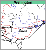 | 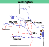 |
Previous Maps and Reports
Aldrick et al. (1992) included the soils of this map unit with the Clydebank and Nuntin Land Systems (dominantly sandy soils). In the present report, they are regarded as alluvial soils. Ward (1977) included them with the Roseneath and Reeve soil associations.
Soils
The soils in this mapping unit have not been well examined. The surface soils are mostly shallow dark brownish grey clay loams or light clays (occasionally medium clays) about 15 cm deep, overlying mottled brownish grey and yellowish brown medium to heavy clays. Sandy clays may appear before 1 m. These soils would possibly be classified as Sodic, Yellow or Brown Dermosols using the Australian Soil Classification.
Chemical and Physical Analysis
No analyses have been carried out on any of these soils.
Land Use
As the soils of this map unit are heavy textured and inclined to be saline, they are not irrigated and are used for grazing.
© State of Victoria (Agriculture Victoria) 1996 - .

This work, Victorian Resources Online, is licensed under a Creative Commons Attribution 4.0 licence. You are free to re-use the work under that licence, on the condition that you credit the State of Victoria (Agriculture Victoria) as author, indicate if changes were made and comply with the other licence terms.
The licence does not apply to ‘branding’ or some ‘images or photographs’ that may be owned by third parties. We ask you to seek prior approval to use images using the VRO feedback form. Access to higher quality images can also be provided on request.
This page was last updated on .