
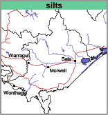
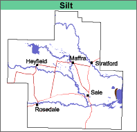
Silts (silts)
| This map unit comprises undifferentiated alluvium and lake sediments, mainly silt and fine sand with some clay, deposited during the Holocene epoch (less than 10 000 years ago).
Landform |
 |  |
These vary according to their position in the landscape, with the more silty and clayey soils being lower and the sandy soils higher. All the soils lack texture contrast.
Chemical and Physical Analysis
No analyses have been carried out on these soils.
Land Use
Uncleared or grazing. The soils are not suited to intensive agriculture.
© State of Victoria (Agriculture Victoria) 1996 - .

This work, Victorian Resources Online, is licensed under a Creative Commons Attribution 4.0 licence. You are free to re-use the work under that licence, on the condition that you credit the State of Victoria (Agriculture Victoria) as author, indicate if changes were made and comply with the other licence terms.
The licence does not apply to ‘branding’ or some ‘images or photographs’ that may be owned by third parties. We ask you to seek prior approval to use images using the VRO feedback form. Access to higher quality images can also be provided on request.
This page was last updated on .