Hayes Hill
|
This information has been obtained from the report: Eruption Points of the Newer Volcanic Province of Victoria by Neville Rosengren. This report was published in 1994 and was prepared for the National Trust of Australia (Victoria) and the Geological Society of Australia (Victorian Division). The review of eruption points was based on an earlier unpublished manuscript Catalogue of the post-Miocene volcanoes of Victoria compiled by O P Singleton and E B Joyce (Geology Department, University of Melbourne 1970). |
| 37 32 30S 145 00 00E (external link); 7922-4-4 (Whittlesea) 233431. 5 km E of Donnybrook. |  Hayes Hill | |
Epping Road. | ||
Whittlesea. | ||
Private land. | Grazing, outcrop. | |
Type 9: | Composite scoria cone overlying lava flows. | |
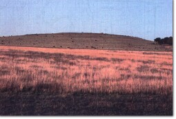
Hayes Hill is a small scoria dome with a final lava flow towards the south. Near the vent on the northern crest of the hill the lava flows preserve original structures but beyond this they are weathered. The lava from this volcano flowed along the ancestral Merri and Darebin Creeks to the valley of the Yarra River at Kew causing the temporary damming of that stream. It continued down the Yarra valley to the present site of Melbourne. | ||
280+ m; 30 m. | ||
Regional: | Although not a distinguished eruption point, this is a significant site as the source of lava that determined long-term landform development along the Merri and Darebin Creeks and the Yarra River. | |
References: | Hanks, W. (1955). Newer Volcanic vents and lava fields between Wallan and Yuroke, Victoria. Proceedings of the Royal Society of Victoria 67, pp. 1-16. Croker, P.J. (1984.). The lava flows between Melbourne and Ballan: their ages and distribution. BSc. (Hons) thesis, University of Melbourne (Unpublished). | |
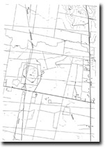
 Hayes Hill 7922-4-4 (Whittlesea) | ||


