
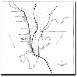
G24 - Woori Yallock - Structural Control of Bend, Gravel Bars
|
This information has been developed from the publications:
|
| Location: | AMG Ref: 706189. Adjacent to the bridge across the Yarra at Woori Yallock. | 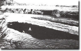 Gravel bars (A) in river at Site G24. |
Access: | From Healesville - Koo-Wee-Rup Road. | |
Geomorphology: | The river is deflected southward around a ridge of Humevale Formation sandstone and siltstone. This rock outcrops in the river bluff west of the Healesville Road. The bed load is of coarse material and there are gravel bars in the channel. | |
Significance: | Local. The site shows the characteristics of the river in the Woori Yallock and Warramate Hills sector of the floodplain where the valley is aligned along the strike of the Palaeozoic bedrock. | |
Management: | Class 3. Public access to the river is possible and could be improved by appropriate signposting and track construction. The geological characteristics of the site would not be damaged by increased use in this way. | |
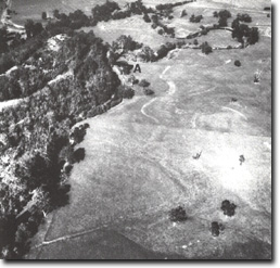 Site G24 extends north along the ridge from (A) |

© State of Victoria (Agriculture Victoria) 1996 - .

This work, Victorian Resources Online, is licensed under a Creative Commons Attribution 4.0 licence. You are free to re-use the work under that licence, on the condition that you credit the State of Victoria (Agriculture Victoria) as author, indicate if changes were made and comply with the other licence terms.
The licence does not apply to ‘branding’ or some ‘images or photographs’ that may be owned by third parties. We ask you to seek prior approval to use images using the VRO feedback form. Access to higher quality images can also be provided on request.
This page was last updated on .