
MM240
| Site: MM240 | Land Unit: Terang Sedimentary |
| Aust. Soil Class.: Ferric, Mottled-Subnatric, Brown SODOSOL (confidence level 2) | |
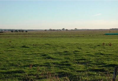 | General Land Unit Description: The unit consists of gently undulating plains on Tertiary sediments, predominantly in the Mortlake– Terang area. The dominant soil type is a Brown Chromosol, either with a mottled subsoil (MM474) or a bleached A2 horizon and a ferric horizon (MM472). There are minor occurrences of Ferric Brown Sodosols which is represented by this site. |
Site Description:
| Geology: Tertiary sedimentary | Landform pattern: Level to gently undulating plains |
| Position in landscape: Flat | Internal drainage: Imperfectly drained |
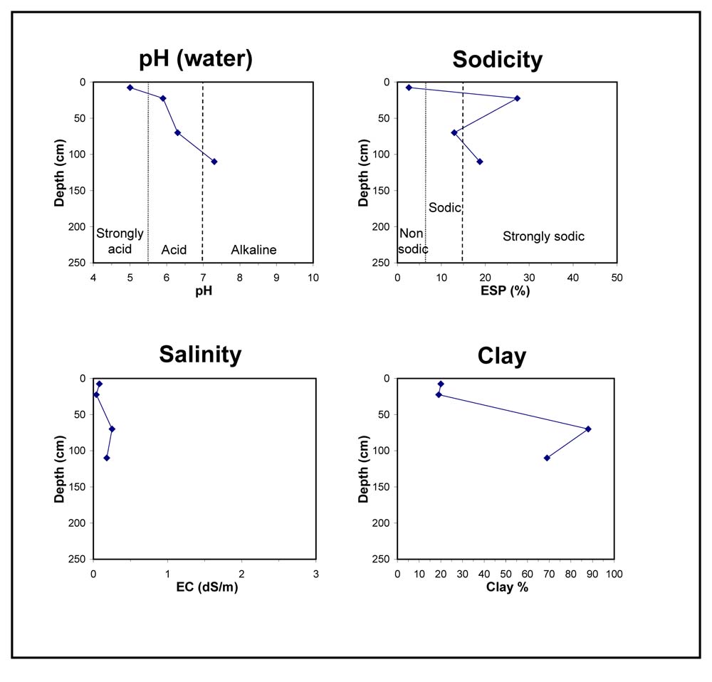
| A1 | 0-15 cm | Dark brown (10YR3/3) fine sandy clay loam, hard-setting surface, apedal, weak consistence when dry, pH 5.0. Clear transition to: |
| A2 | 15-30 cm | Greyish brown (10YR5/2), sporadically bleached (10YR7/2) when dry, ferromanganiferous nodules are abundant, weak consistence when dry, pH 5.9. Sharp transition to: |
| Subsoil | ||
| B21 | 30-110 cm | Yellowish brown (10YR5/6) medium clay, red mottles, strong blocky structure (10-20 mm), firm consistence when moist, pH 6.3. Gradual transition to: |
| B22 | 110+ cm | Yellowish brown (10YR5/6), red mottles, strong blocky structure, coarse fragments (200-600 mm), very firm consistence when moist, pH(water) 7.3. |
Key profile features:
- Strongly acidic topsoil
- Strong texture contrast between topsoil and subsoil
- Sodic subsoil
- Many ferromanganiferous nodules
© State of Victoria (Agriculture Victoria) 1996 - .

This work, Victorian Resources Online, is licensed under a Creative Commons Attribution 4.0 licence. You are free to re-use the work under that licence, on the condition that you credit the State of Victoria (Agriculture Victoria) as author, indicate if changes were made and comply with the other licence terms.
The licence does not apply to ‘branding’ or some ‘images or photographs’ that may be owned by third parties. We ask you to seek prior approval to use images using the VRO feedback form. Access to higher quality images can also be provided on request.
This page was last updated on .