
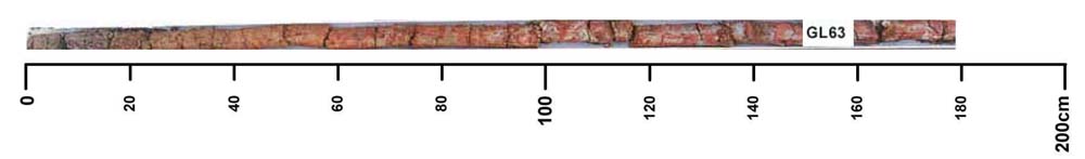
GL63
| Site: GL63 | Land Unit: Condah Basalt |
| Aust. Soil Class.: Ferric, Eutrophic, Yellow CHROMOSOL (confidence level 1) | |
 | General Land Unit Description: The undulating plains and rises of the Condah area mainly consist of Ferric Chromosols. On the lower slopes bleached A2 horizons and mottled subsoils are common. On the broad level crests, gilgai microrelief is common. |
Site Description:
| Slope: 2% | Geology: Quaternary basalt |
| Landform pattern: Level to gently undulating plains | Position in landscape: Crest |
| Internal drainage: Moderately well drained |
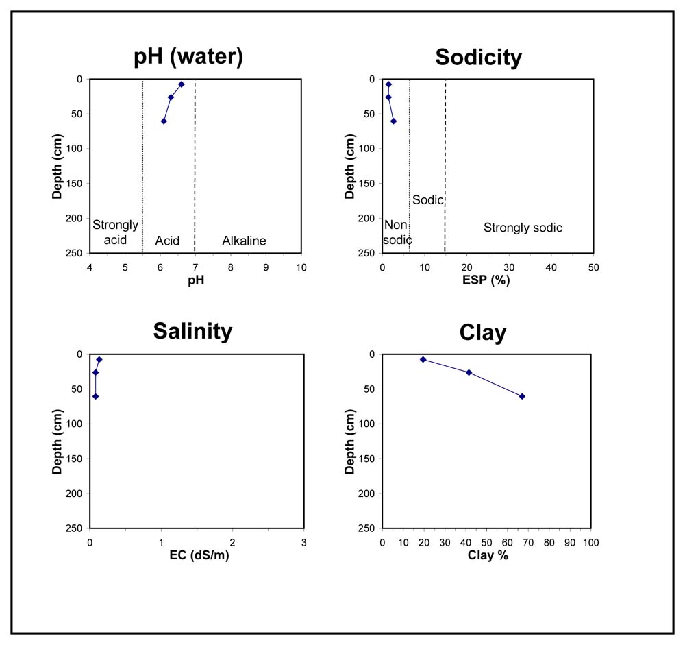
| A1 | 0-10 cm | Very dark greyish brown (10YR3/2) fine sandy clay loam, strong polyhedral structure (5-15 mm), firm consistence when dry, many small subrounded ferromanganiferous nodules (2-5 mm), pH 7. Clear transition to: |
| Subsoil | ||
| B1 | 10-20 cm | Very dark greyish brown (10YR3/2), sandy clay, faint medium orange mottles are common, massive structure, very firm consistence when dry, pH 6.5. Clear transition to: |
| B2 | 20-50 cm | Brownish yellow (10YR6/6), light clay, distinct medium orange and red mottles are common, moderate to strong polyhedral structure (10-20 mm), very firm consistence when dry, many small subrounded ferromanganiferous nodules (2-5 mm), pH 6. Diffuse transition to: |
| BC | 50-106 cm | Many distinct medium red and orange mottles (5-15 mm), strong subangular blocky structure, firm consistence when dry. |
Key profile features:
- Strong texture contrast between topsoil and subsoil
- Many ferromanganiferous nodules in topsoil
- Mottled subsoil
© State of Victoria (Agriculture Victoria) 1996 - .

This work, Victorian Resources Online, is licensed under a Creative Commons Attribution 4.0 licence. You are free to re-use the work under that licence, on the condition that you credit the State of Victoria (Agriculture Victoria) as author, indicate if changes were made and comply with the other licence terms.
The licence does not apply to ‘branding’ or some ‘images or photographs’ that may be owned by third parties. We ask you to seek prior approval to use images using the VRO feedback form. Access to higher quality images can also be provided on request.
This page was last updated on .