
Basalt Plain Land Unit
The Basalt plains have been divided into fifteen subdivisions. These are actually aggregations based on ninety seven (97) land units mapped in the plains by Maher and Martin (1984). The original land units described by Maher and Martin (1984) were based on location, but because of the extensive nature of the Basalt plains in the region, we have chosen in this study to amalgamate units on the basis of their common soil properties. The amalgamated units includes a supplement of related landforms to these groupings:
Common soil properties | Related landforms | |
| Texture Group | Distinguishing properties | |
| Uniform | Shallow (1) | Stony rises and crests/upper slopes of cones and low hills |
| Gradational | Shallow and friable (2) | Upper slopes of cones, low hills and rises |
| Deep – with a bleached horizon (3) | Lower slopes of cones, low hills and rises | |
| Deep – without a bleached horizon (4) | Middle slopes of cones, low hills and rises | |
| Duplex | Free draining and sodic (5) | Rises and undulating plains |
| Free draining, sodic and bleached and/or ferric (6) | ||
| Free draining and non-sodic (7) | Low hills, rises and undulating plains | |
| Free draining and non-sodic and bleached and/or ferric (8) | ||
| Not free draining and sodic (9) | Level to gently undulating plains and drainage depressions | |
| Not free draining, sodic and bleached and/or ferric (10) | ||
| Not free draining and non-sodic (11) | ||
| Uniform | Self mulching (13) | Drainage depressions, broad gentle to level plains |
| Not self mulching (14) | ||
| Sodic (15) | ||
These units cover most of the southern and eastern part of the region. There were two major lava flows that occurred in the region. The first flow resulted in the formation of the extensive plain that forms the majority of the land units. These land units are mainly level to gently undulating plains, although there are some areas dissected by major waterways. There are also areas of stony rises. The second flow resulted in the formation of scoria cones such as Mt Napier and Mt Eccles. These cones are often formed as rolling rises or low hills.
A sequence of soil/regolith development has been proposed by Joyce and Ollier based on the earlier Land Systems study of the South West by Gibbons and Downes. This essentially relates the soil depth and profile development to the age of the lava flows and assumes a spatially consistent climate and, to some degree, a similar degree of weathering of each flow.
The soils are variable throughout the Basalt LUs although they commonly fall into the hromosol, Sodosol or Vertosol soil orders. The Chromosols and Kurosols often have ferromanganiferous nodules above the clay subsoil, often have a bleached A2 horizon and mottled subsoil, and commonly have impeded internal drainage. There are small areas of well-structured red soils that have a significant free iron oxide content (free Fe2+) in the subsoil (Ferrosols). These soils tend to be quite productive and are often well suited to viticulture. Areas where these soils occur are between Portland and Dartmoor and scattered occurrences around Hamilton. Due to restrictions of scale, they have not been mapped individually.
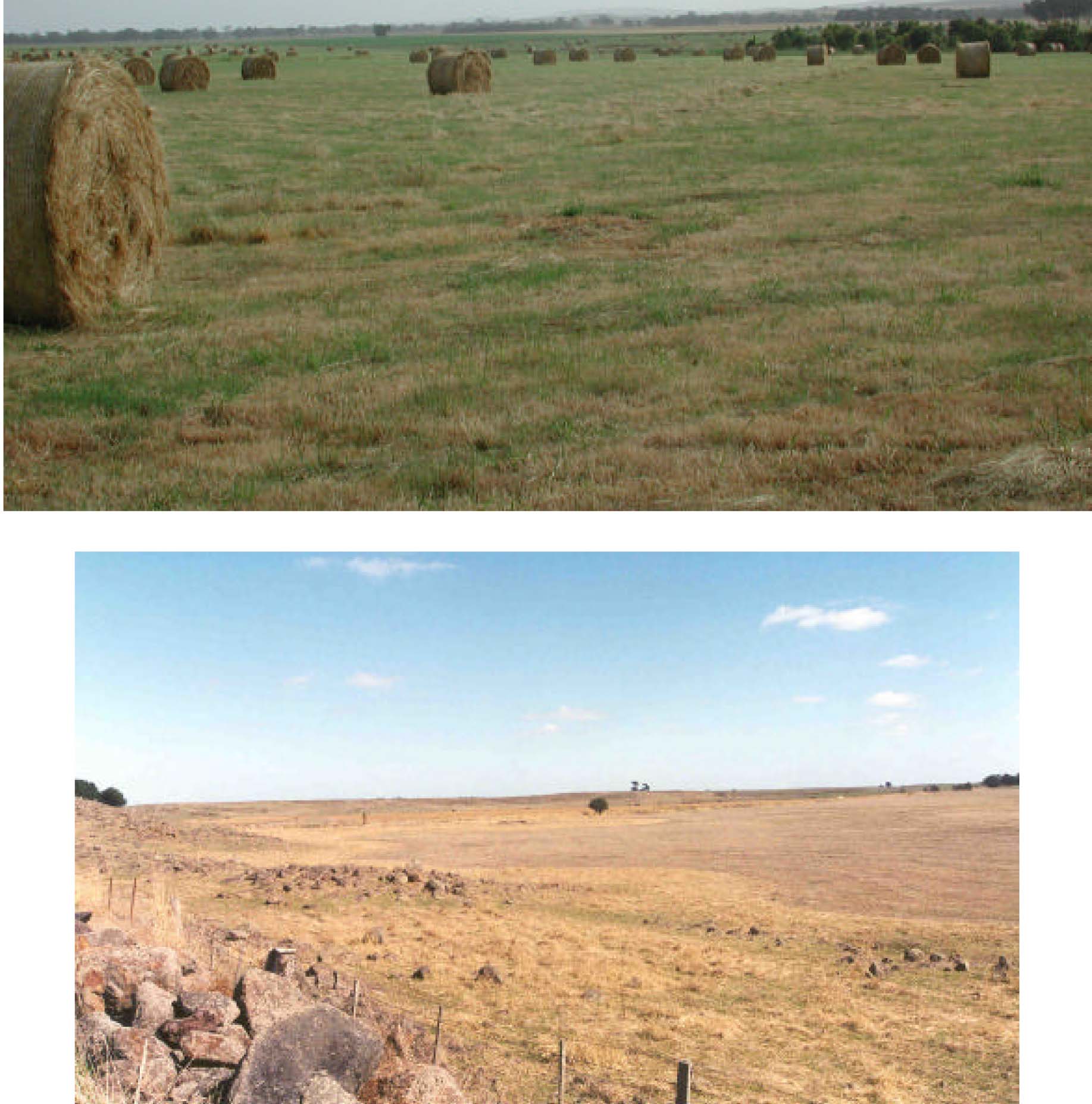 Plates 12, 13, 14 & 15 The basalt land units comprise a suite of differing units. This includes stony rises, scoria cones and deposits, swamps and plains. Included in these Plates are a gently undulating basalt plain near Moyston (Plate 12), stony rises near Minhamite (Plate 13), a scoria cone near Penshurst-Mount Napier (Plate 14) and red basalt soils between Hamilton and Wannon (Plate 15). | 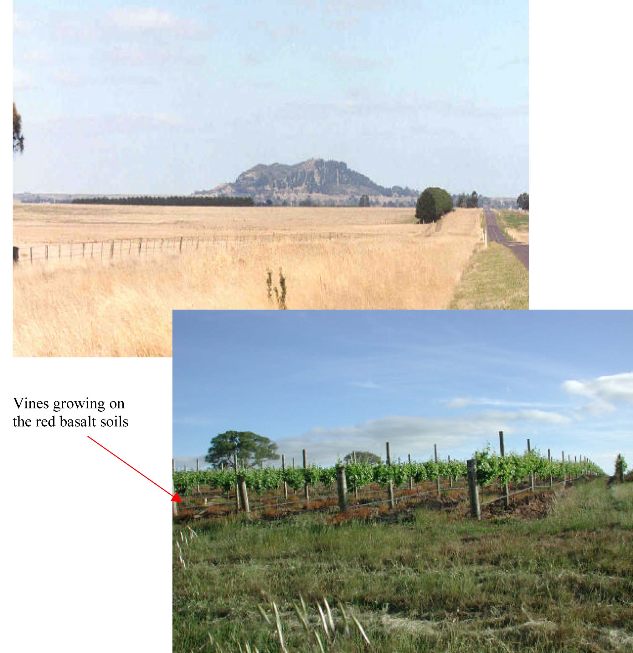 |
© State of Victoria (Agriculture Victoria) 1996 - .

This work, Victorian Resources Online, is licensed under a Creative Commons Attribution 4.0 licence. You are free to re-use the work under that licence, on the condition that you credit the State of Victoria (Agriculture Victoria) as author, indicate if changes were made and comply with the other licence terms.
The licence does not apply to ‘branding’ or some ‘images or photographs’ that may be owned by third parties. We ask you to seek prior approval to use images using the VRO feedback form. Access to higher quality images can also be provided on request.
This page was last updated on .