
Ararat Granite Land Unit
This land unit consists of the granitic hills, low hills and rises east and south of Ararat. The hills and rises often have long gentle slopes leading to the plains commonly coming off a rocky crest. Rock outcrop is common at the break-of-slope, although it is generally absent on the lower slope. Soil depth is variable although soils are generally shallow (less than 50 cm deep), particularly on the crests and steep slopes. Granite floaters may occur at varying depths. There is often a deep C horizon (weathered granitic rock) present. The C horizon tends to act as a barrier for water penetration. The deeper subsoil commonly has an intermittent gleyed appearance, which supports this. The dominant soil types are Grey Sodosols or Brown Chromosols. The subsoil structure tends to be prismatic, and in many cases will be sodic. The steeper slopes and rocky crests have a lower capacity to support intensive land uses (compared to the long gentle slopes) due to land and soil limitations.
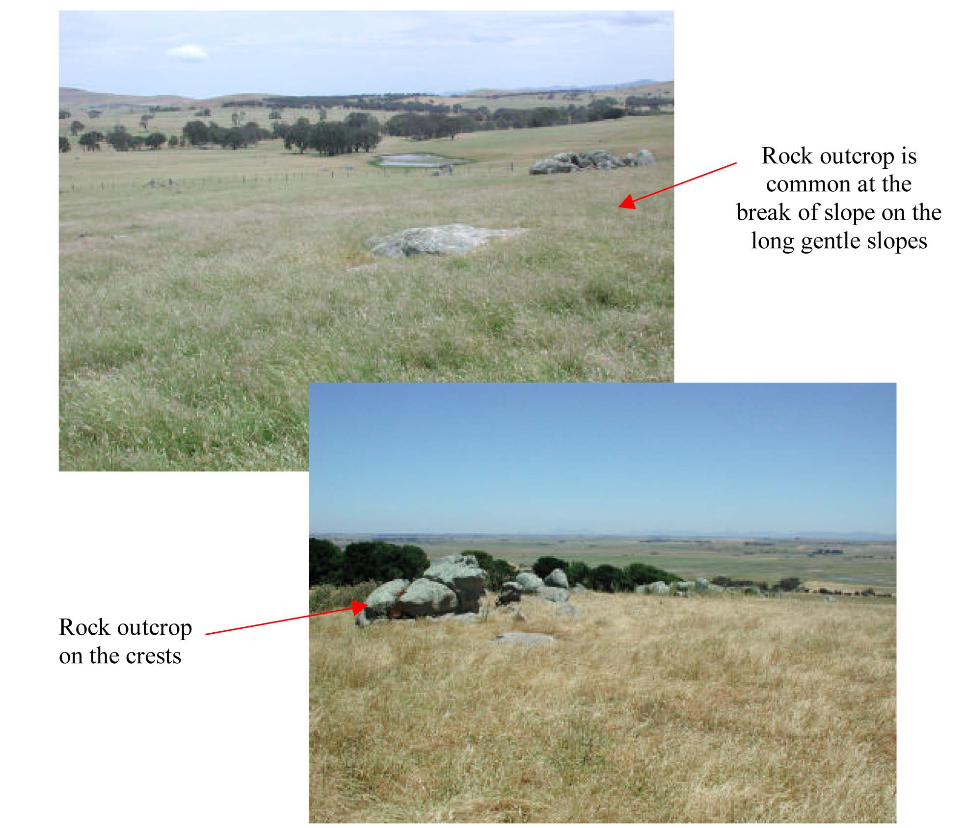
Plates 4 & 5 Ordovician granite outcropping on the southern colluvial slopes of Rocky Point (Plate 4) and further
south on Rocky Rises Road near Maroona (Plate 5).
© State of Victoria (Agriculture Victoria) 1996 - .

This work, Victorian Resources Online, is licensed under a Creative Commons Attribution 4.0 licence. You are free to re-use the work under that licence, on the condition that you credit the State of Victoria (Agriculture Victoria) as author, indicate if changes were made and comply with the other licence terms.
The licence does not apply to ‘branding’ or some ‘images or photographs’ that may be owned by third parties. We ask you to seek prior approval to use images using the VRO feedback form. Access to higher quality images can also be provided on request.
This page was last updated on .