
SFS19b
Location: Teesdale.
Australian Soil Classification: Ferric, Eutrophic, Brown CHROMOSOL
General Landscape Description: Level plain within a gently undulating plain tending to gently undulating rises
Site Description: Southern Farming Systems (SFS) raised bed site.
Geology: Moorabool Viaduct Formation
Native Vegetation: Remnant Red gum (Eucalyptus camaldulensis).
Land Use: Wheat.
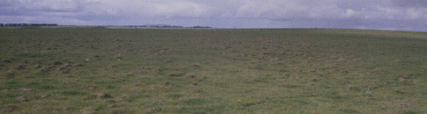 SFS19b Landscape. |
Soil Profile Morphology:
Surface Soil
| Ap | 0-18 cm | Loam: | 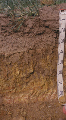 SFS19b Profile. |
| A2c | 18-30/35 | Abundant coarse gravel with slight alluvial quartz; abrupt and wavy change to: | |
| Subsoil | |||
| B21 | 30/35-65 cm | Brown (10YR4/3) with red (10R4/8) mottles; light clay; coarse ferruginised sand, bleached margins of fractures which contain illuviated clay; strong consistence dry; pH 6.0. |
Key Profile Features:
- Strong texture contrast between surface (A) horizons and subsoil (B21) horizon.
Soil Profile Characteristics:
pH | Salinity Rating | |||
Subsoil (B21 horizon) | Moderately Acid | Low | Non-Sodic | None1 |
Horizon | Horizon Depth (cm) | pH (water) | pH (CaCl2) | EC dS/m | Exchangeable Cations | |||
Ca | Mg | K | Na | |||||
meq/100g | ||||||||
B21 | 30-65 | 6.0 | 5.4 | 0.20 | 4.7 | 7.9 | 1.1 | 1.2 |
Horizon | Horizon Depth (cm) | Exchangeable Aluminium mg/kg | Exchangeable Acidity meq/100g | Field Capacity pF2.5 | Wilting Point pF4.2 | Coarse Sand (0.2-2.0 mm) | Fine Sand (0.02-0.2 mm) | Silt (0.002-0.02 mm) | Clay (<0.002 mm) |
B21 | 30-65 | <10 | 11.0 | 40.5 | 28.5 | 6 | 3 | 3 | 88 |
Management Considerations:
Whole Profile
- Plant available water capacity (PAWC) is considered to be low/medium (estimated at 100 mm) in the upper 80 cm of this soil profile. Effective rooting depth (ERD) is restricted to 80 cm due to the basalt below this depth.
Profile Described By: Richard MacEwan & Mark Imhof (September 2000).
© State of Victoria (Agriculture Victoria) 1996 - .

This work, Victorian Resources Online, is licensed under a Creative Commons Attribution 4.0 licence. You are free to re-use the work under that licence, on the condition that you credit the State of Victoria (Agriculture Victoria) as author, indicate if changes were made and comply with the other licence terms.
The licence does not apply to ‘branding’ or some ‘images or photographs’ that may be owned by third parties. We ask you to seek prior approval to use images using the VRO feedback form. Access to higher quality images can also be provided on request.
This page was last updated on .