
H82
Australian Soil Classification: Mottled Brown KUROSOL
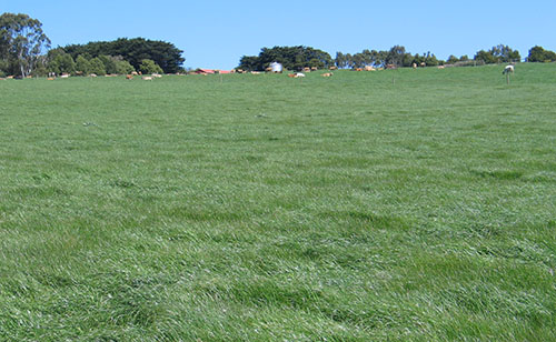
General Landscape Description: Edge of Dissected Plain, Hill Slope
Site Description: Upper Slope
Vegetation: Pasture
Geology: Palaeogene and Neogene Sediments, Quaternary Colluvium
Soil Profile Morphology:
Surface Soil
| A1 | 0-25 cm | Very dark greyish brown (10Y3/2); light clay; strong polyhedral structure; very firm consistence, dry; pH 7.5; gradual change to: | 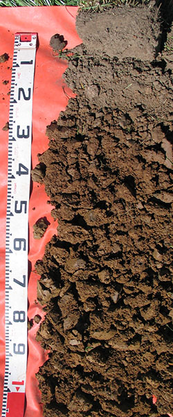 H82 Profile H82 Profile |
| Subsoil | |||
| B21 | 25-60 cm | Brown (7.5YR4/4); medium heavy clay; strong polyhedral structure; very firm consistence, slightly moist; pH 5.0; gradual change to: | |
| B22 | 60-90 cm | Dark yellowish brown (10YR4/4); medium heavy clay; strong polyhedral structure; very firm consistence, moist, pH 5.0; diffuse change to: | |
| B23 | 90-110 cm | Dark yellowish brown (10YR4/6); common fine distinct dark grey (7.5YR4/1) and red (2.5YR4/6) mottles; medium heavy clay; moderate polyhedral structure; very firm consistence, moist, pH 5.0. | |
Chemical Properties of Upper 10 cm:
Depth (cm) | pH (water) | pH (CaCl2) | EC dS/m | Exchangeable Cations | Total Carbon % | Total Nitrogen % | Organic Matter % | Available Aluminium mg/kg | Available Potassium (Skene K) mg/kg | Phosphorous (Olsen P) mg/kg | Available Sulphur mg/kg | Phosphorous Buffering Index | |||
Ca | Mg | K | Na | ||||||||||||
meq/100g | |||||||||||||||
0-10 | 5.3 | 4.8 | 0.11 | 5.1 | 1.3 | 0.34 | 0.24 | 4.7 | 0.33 | 8.7 | 11 | 160 | 8 | 7 | 97 |
Physical Properties of Upper 10 cm:
Depth (cm) | Bulk Density kg/L | Volumetric Water | Dispersion | Slaking | ||||||
At Saturation pF0 mL/100mL | Near Saturation pF1.0 mL/100mL | Field Capacity pF2.0 mL/100mL | Wilting Point pF4.2 mL/100mL | Dry | Remoulded | |||||
2 Hour | 20 Hour | 2 Hour | 20 Hour | |||||||
0-10 | 1.20 | 54.4 | 48.9 | 46.4 | 9.0 | Nil | Nil | Nil | Slight | Water Stable |
Profile Described By: David Rees, October 2006.
© State of Victoria (Agriculture Victoria) 1996 - .

This work, Victorian Resources Online, is licensed under a Creative Commons Attribution 4.0 licence. You are free to re-use the work under that licence, on the condition that you credit the State of Victoria (Agriculture Victoria) as author, indicate if changes were made and comply with the other licence terms.
The licence does not apply to ‘branding’ or some ‘images or photographs’ that may be owned by third parties. We ask you to seek prior approval to use images using the VRO feedback form. Access to higher quality images can also be provided on request.
This page was last updated on .