
Dookie
Geology of the Dookie Region | Dookie Soil Pits
| 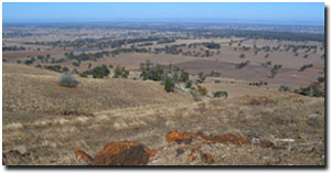 View from Mt Major looking south (Photo: David Rees, DPI). |
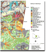
This detailed soil map was originally published in the above report: 'Soil, Land-Use and Erosion Survey around Dookie, Victoria' by R.G Downes (1949). It covers an area of 438 square kilometres and was prepared at a scale of 1:32 000. Some 27 Soil Reference Sites are associated with this map - details of which can be found in the original report. |
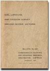
Soil, Land-Use and Erosion Survey Around Dookie, Victoria.
To view the information PDF requires the use of a PDF reader. This can be installed for free from the Adobe website (external link).
 | Parts 1, 2 & 3 - Introduction, Climate & Vegetation. | ||||
| Summary (PDF 40KB) | Part A (PDF 1.4MB) | Part B (PDF 434KB) | |||
Parts 4 & 5 - Geology and Physiography, Soils Classification and Relationships. (PDF 861KB) | Parts 6 & 7 - Soils Chemical and Physical Characteristics, Soil Erosion. (PDF 1.2MB) | Parts 8, 9, 10 & 11 - Watersheds and Drainage Pattern, Agriculture and Land Use, Acknowledgements, References. (PDF 1.3MB) | |||
Topography, Hydrography and Soil Erosion Map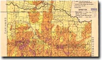 Dookie Topography, Hydrography and Soil Erosion | Soil Association Map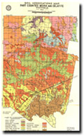 Soil Association, Part Counties Moira & Delatite | Land Class Map 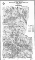 Dookie Land Class |

© The State of Victoria, 1996 - .
This page was last updated on .