
WLRA140
|
| WLRA140 | 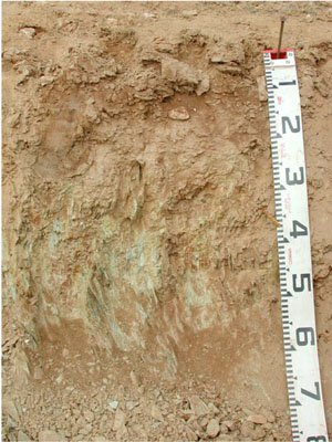 Mottled, Magnesic, Brown CHROMOSOL | |
|
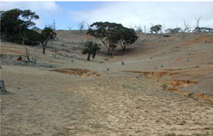
Location | Ararat-St Arnaud Road, Joel South, western Victoria | |||
|
Landform | Hill | |||
|
Geology | Palaeozoic (Cambrian) Warrak Formation: marine sandstone, siltstone, schist | |||
|
Element | Hillslope | |||
|
Slope | 15% | |||
|
Aspect | West | |||
Horizon | Depth (cm) | Description | ||
A1 | 0–15 | Strong brown (7.5YR4/6); loam, fine sandy; apedal (structureless); firm dry consistence; many small to medium angular quartz and angular platy weakly metamorphosed siltstone; few fine and very fine roots; pH 5.4; clear and smooth boundary to: | ||
B2 | 15–35 | Light olive brown (2.5Y5/4) with many medium distinct red (2.5YR4/6) inclusions of substrate material as mottles; silty clay loam; moderate fine to medium subangular blocky structure; smooth ped-fabric; very firm dry consistence; many small to medium angular quartz and angular platy weakly metamorphosed siltstone; few fine and very fine roots; pH 5.9; clear irregular boundary to: | ||
C | 35–75+ | Weathered weakly metamorphosed siltstone; field pH 7.0. | ||
| Management Considerations | ||||
| ||||
Horizon | Depth (cm) | pH (water) | pH (CaCl2) | EC dS/m | Exch. Al mg/kg | Exchangeable Cations cmol-/kg | Field Capacity (pF2.5) | Wilting Point (pF4.2) | Coarse Sand % | Fine Sand % | Silt % | Clay % | |||
Ca | Mg | K | Na | ||||||||||||
A1 | 0–15 | 5.4 | 4.5 | <0.05 | 56 | 1.4 | 1 | 0.46 | 0.11 | 25.3 | 6.3 | 19.8 | 45.6 | 18.5 | 12 |
B2 | 15–35 | 5.9 | 4.9 | 0.06 | 24 | 0.46 | 11 | 0.6 | 0.45 | 33.3 | 17.9 | 5 | 26.3 | 23 | 41.5 |
© State of Victoria (Agriculture Victoria) 1996 - .

This work, Victorian Resources Online, is licensed under a Creative Commons Attribution 4.0 licence. You are free to re-use the work under that licence, on the condition that you credit the State of Victoria (Agriculture Victoria) as author, indicate if changes were made and comply with the other licence terms.
The licence does not apply to ‘branding’ or some ‘images or photographs’ that may be owned by third parties. We ask you to seek prior approval to use images using the VRO feedback form. Access to higher quality images can also be provided on request.
This page was last updated on .