
LSWW01
|
Location | Telopea Downs Road, Servicetown North, western Victoria | ||
|
Landform | Rise (minor) | |||
|
Geology | Quaternary Woorinen Formation: aeolian dune sand, calcareous clay | |||
|
Element | Hillslope | |||
Horizon | Depth (cm) | Description | ||
A1 | 0–10 | Brown (10YR5/3); loamy fine sand; single grain (structureless); loose consistence when dry; hydrophobic; pH 6.1; abrupt and wavy boundary to: | 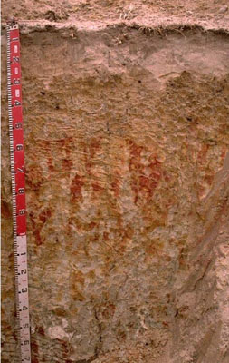 Vertic & Bleached-Sodic, Calcic, Grey CHROMOSOL | |
A2 | 10–25 | Very pale brown (10YR7/4); sand; conspicuously bleached when dry; pH 7.2; sharp and wavy boundary to: | ||
B21 | 25–55 | Pale brown (10YR6/3) with many coarse faint reddish yellow mottles; medium clay (sandy) strong coarse angular blocky, parting to medium angular blocky structure; smooth ped-fabric; few (2-5%) soft calcium carbonate segregations; pH 8.7 (completely disperses after reworking); abrupt and wavy boundary to: | ||
B22 | 55–105 | Brownish yellow (10YR6/6) with many very coarse prominent dark yellowish brown and light grey mottles; sandy clay loam; massive (structureless); very few soft calcium carbonate segregations; pH 9.3 (strongly dispersive when dry); clear and wavy boundary to: | ||
B31 | 105–140 | Light grey (10YR7/1) with common coarse distinct brownish yellow mottles; light fine sandy clay loam; massive (structureless)to weakly structured; very few (<2%) soft calcareous segregations; pH 9.7; clear and wavy boundary to: | ||
B32 | 140–180+ | Light grey (5Y7/1) with common very coarse prominent dark yellowish brown mottles; light medium clay; moderate to strong coarse polyhedral, parting to medium polyhedral structure; smooth ped-fabric; few slickensides; few calcareous segregations; pH 9.8. | ||
Management Considerations | ||||
| ||||

Horizon | Depth (cm) | pH (water) | pH (CaCl2) | EC dS/m | NaCl % | Exchangeable Cations cmol-/kg | Wilting Point (pF4.2) | Coarse Sand % | Fine Sand % | Silt % | Clay % | |||
Ca | Mg | K | Na | |||||||||||
A1 | 0–10 | 6.1 | 5.5 | 0.1 | 2.4 | 0.4 | 0.4 | 0.1 | 5.3 | 10.3 | 80.6 | 3 | 3.5 | |
A2 | 10–25 | 7.2 | 6.2 | <0.05 | - | - | - | - | 1.4 | 10.6 | 84.2 | 1.5 | 2.5 | |
B21 | 25–55 | 8.7 | 8 | 0.16 | 9.6 | 4.6 | 1.8 | 0.8 | 18.0 | 7 | 40.8 | 1.5 | 46 | |
B22 | 55–105 | 9.3 | 8.2 | 0.15 | 3.6 | 3.4 | 1.1 | 1.1 | 9.8 | 8 | 65.2 | 2 | 22.5 | |
B31 | 105–140 | 9.7 | 8.5 | 0.2 | ||||||||||
B32 | 140–180+ | 9.8 | 8.7 | 0.46 | <0.05 | |||||||||
© State of Victoria (Agriculture Victoria) 1996 - .

This work, Victorian Resources Online, is licensed under a Creative Commons Attribution 4.0 licence. You are free to re-use the work under that licence, on the condition that you credit the State of Victoria (Agriculture Victoria) as author, indicate if changes were made and comply with the other licence terms.
The licence does not apply to ‘branding’ or some ‘images or photographs’ that may be owned by third parties. We ask you to seek prior approval to use images using the VRO feedback form. Access to higher quality images can also be provided on request.
This page was last updated on .