
IS25
Location: Haven
Australian Soil Classification: Calcic, Subnatric, Grey SODOSOL
Northcote Factual Key: Ug5.28
Great Soil Group: grey clay
Soil Type: Murtoa Clay.
General Landscape Description: Swale within a Dunefield
Geology: Quaternary Shepparton Formation: fluvial silt, sand and minor gravel
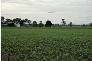
| IS25 Landscape |
Soil Profile Morphology:
Surface Soil
| A11 | 0-10 | Dark grey (10YR4/1); light clay; subplastic; cracking and self-mulching surface condition; weak coarse subangular blocky structure; very strong consistence dry; slightly sticky consistence wet; pH 6.6: | ||
| A12 | 10-20 | Dark grey (10YR4/1); medium clay; subplastic; cracking and self-mulching condition; weak coarse subangular blocky structure; very strong consistence dry; slightly sticky consistence wet; pH 7.7; sharp boundary to: | ||
| Subsoil | ||||
| B21 | 20-35 | Light brownish grey (2.5Y6/3); light medium clay; subplastic; moderate coarse blocky structure; very strong consistence dry; slightly sticky consistence wet; pH 8.1: | ||
| B22 | 35-90 | Pale olive (5Y6/3); medium heavy clay; very plastic; moderate coarse subangular blocky structure; very strong consistence dry; slightly sticky consistence wet; pH 9.1: | ||
| B23 | 90-135 | Pale olive (5Y6/3); medium heavy clay; very plastic; strong coarse subangular blocky structure; strong consistence dry; slightly sticky consistence wet; very few (<2%) soft carbonate segregations; pH 9.4: | ||
| B24 | 135-160 | Pale olive (5Y6/3); medium heavy clay; very plastic; strong coarse subangular blocky structure; strong consistence dry; slightly sticky consistence wet; pH 9.1; gradual boundary to: | ||
| B31 | 160-200 | Pale yellow (5Y7/4); heavy clay; very plastic; strong coarse subangular blocky structure; strong consistence dry; slightly sticky consistence wet; pH 8.9: | ||
| B32 | 200-220 | Pale yellow (5Y7/4); heavy clay; very plastic; strong coarse subangular blocky structure; strong consistence dry; slightly sticky consistence wet; pH 7.7. | ||
Chemical and Physical Analysis:
Horizon | Sample Depth cm | pH H2O | EC dS/m | Sodium Chloride % | Exchangeable Calcium cmol-/kg | Exchangeable Magnesium cmol-/kg | Exchangeable Potassium cmol-/kg | Exchangeable Sodium cmol-/kg | Total Nitrogen % | Exchangeable Acidity cmol-/kg | Organic Carbon % | Permanent Wilting Point -1500okPa | Coarse Sand % | Fine Sand % | Silt % | Clay % |
A11 | 0–10 | 6.6 | 0.17 | 0.02 | 8.6 | 4.7 | 2.1 | 0.2 | 0.16 | 5 | 1.8 | 13.5 | 16 | 39 | 10 | 34 |
A12 | 10–20 | 7.7 | 0.12 | 0.01 | 8.9 | 6.3 | 1.5 | 0.5 | 0.06 | 3.7 | 0.67 | 15.1 | 15 | 36 | 11 | 39 |
B21 | 20–35 | 8.1 | 0.14 | 0.02 | 7.1 | 6.6 | 1 | 1.9 | 0.04 | 3.1 | 0.42 | 15.3 | 14 | 39 | 11 | 35 |
B22 | 35–90 | 9.1 | 0.33 | 0.04 | 5.5 | 9 | 1.4 | 5 | 0.02 | 0.19 | 20.6 | 13 | 33 | 12 | 42 | |
B23 | 90–135 | 9.4 | 0.94 | 0.12 | 5.4 | 10.6 | 1.4 | 8.8 | 0.01 | 0.12 | 20.3 | 11 | 23 | 11 | 47 | |
B24 | 135–160 | 9.1 | 1.11 | 0.25 | 19.2 | 15 | 26 | 10 | 47 | |||||||
B31 | 160–200 | 8.9 | 1.21 | 0.2 | 19.7 | 11 | 28 | 11 | 47 | |||||||
B32 | 200–220 | 7.7 | 1.28 | 0.21 | 20.6 | 12 | 27 | 9 | 50 |
Management Considerations:
- Gradational profile, medium to heavy texture range with vertic properties.
- Neutral upper soil over alkaline and sodic subsoil. Slight decrease at depth.
- Upper soil (A horizons) indicate some organic matter content.
- Sodicity increases below upper subsoil (below 35 cm).
- Subsoil has yellow hue (5Y) and pale colours indicating reducing conditions, limited drainage and air movement.
- Landscape element, swale; very slow site drainage.
Profile Described By: John Martin, Nabil Badawy, Ron Cawood, Geoff Pope, John Galea, John Turner (1970).
© State of Victoria (Agriculture Victoria) 1996 - .

This work, Victorian Resources Online, is licensed under a Creative Commons Attribution 4.0 licence. You are free to re-use the work under that licence, on the condition that you credit the State of Victoria (Agriculture Victoria) as author, indicate if changes were made and comply with the other licence terms.
The licence does not apply to ‘branding’ or some ‘images or photographs’ that may be owned by third parties. We ask you to seek prior approval to use images using the VRO feedback form. Access to higher quality images can also be provided on request.
This page was last updated on .