
Wandocka with Nuntin (Wa/Nt)
|
This map unit comprises mainly Wandocka with less than 30% of the Nuntin map unit. A small area occurs south of Clydebank. | 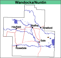 |
Unknown, probably grassland.
Previous Maps and Reports
This mapping unit was included under the Clydebank land system by Aldrick et al (1992).
Soils
See Wandocka and Nuntin map units.
Land Use
The land is mostly used for annual or irrigated pastures. Salinity can be a major problem.
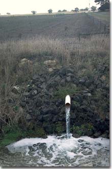 Ground water pumping in the Wandocka unit west of Lake Wellington. Note the east-west dune (Nuntin mapping unit) in background. |
© State of Victoria (Agriculture Victoria) 1996 - .

This work, Victorian Resources Online, is licensed under a Creative Commons Attribution 4.0 licence. You are free to re-use the work under that licence, on the condition that you credit the State of Victoria (Agriculture Victoria) as author, indicate if changes were made and comply with the other licence terms.
The licence does not apply to ‘branding’ or some ‘images or photographs’ that may be owned by third parties. We ask you to seek prior approval to use images using the VRO feedback form. Access to higher quality images can also be provided on request.
This page was last updated on .