
Merrimans Creek (Mc)
| Geology Quaternary (Late Pleistocene) alluvium. Landform Alluvial terrace. This is an earlier flood plain of Merrimans Creek. Original Vegetation Little remains of the original vegetation. | 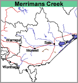 | 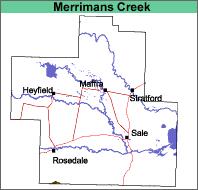 |
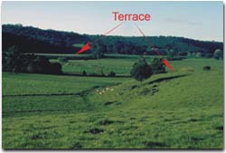 This image shows the first terrace of Merriman's Creek. This is part of the Merriman's Creek map unit. The floodplain below the terrace is part of the Riverine map unit. |
|
Previous Maps and Reports
No previously published reports cover these soils.
Soils
The surface soils are generally shallow very dark grey to very dark greyish brown clay loams about 15 to 20 cm deep, overlying yellowish brown to olive brown medium clays. Some areas may have light clay surface soils.
Chemical and Physical Analysis
No analyses have been carried out on these soils.
Land Use
Grazing of sheep and cattle is generally carried out on this map unit. They are too clayey to have any horticultural potential.
© State of Victoria (Agriculture Victoria) 1996 - .

This work, Victorian Resources Online, is licensed under a Creative Commons Attribution 4.0 licence. You are free to re-use the work under that licence, on the condition that you credit the State of Victoria (Agriculture Victoria) as author, indicate if changes were made and comply with the other licence terms.
The licence does not apply to ‘branding’ or some ‘images or photographs’ that may be owned by third parties. We ask you to seek prior approval to use images using the VRO feedback form. Access to higher quality images can also be provided on request.
This page was last updated on .