
La Trobe (Lt)
|
Geology | 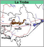 | 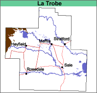 |
Rolling to steep hills.
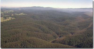 Part of the La Trobe mapping unit from the air. |
Original Vegetation
Open forest. Eucalypt species include silvertop, messmate, red, white and silver leaf stringybark, ironbark, red box, longleaf box, narrow-leaf and broad-leaf peppermint.
Previous Maps and Reports
This map unit includes both the Wonnangatta land system and the La Trobe Land System as described by Aldrick et al. (1992). These land systems were largely separated on the basis of rainfall, with the La Trobe land system generally receiving more than 1000 mm.
Soils
Most of the soils are on moderately steep slopes and have dark brownish grey very fine sandy to silty clay loam surface soils overlying, at about 15 cm, pale brown very fine sandy to silty clay loams. Mottled yellowish to reddish brown and light brownish grey light clays occur at about 30 cm, passing to medium clay at about 40 cm. Light clays may reappear with depth. The depth to rock varies, with shallower soils occurring on exposed, drier and steeper slopes. Decomposing rock generally occurs between 0.7 and 1.2 m. Fragments of decomposing rock may occur throughout the soil profile. The soils are most likely to be classified as Brown, Red or Yellow Kurosols using the Australian Soil Classification, especially in higher rainfall areas.
Chemical and Physical Analysis
Only one soil profile has been described on this map unit. Soil pit Site GP86 (a Red Kurosol) is located near Lake Glenmaggie and has very strongly acid surface horizons overlying a strongly acid and magnesic subsoil.
Land Use
Mostly forestry, small areas are used for grazing.
© State of Victoria (Agriculture Victoria) 1996 - .

This work, Victorian Resources Online, is licensed under a Creative Commons Attribution 4.0 licence. You are free to re-use the work under that licence, on the condition that you credit the State of Victoria (Agriculture Victoria) as author, indicate if changes were made and comply with the other licence terms.
The licence does not apply to ‘branding’ or some ‘images or photographs’ that may be owned by third parties. We ask you to seek prior approval to use images using the VRO feedback form. Access to higher quality images can also be provided on request.
This page was last updated on .