
Fernbank (Fe)
|
Geology |  |  |
| Original Vegetation The original vegetation was a mixed open forest mainly comprising stringybark, box and red gum. Now only remnant vegetation remains. Previous Maps and Reports This map unit was identified and named as Fernbank by Ward (1977). It is included within the Redgum 1 and Stockdale Land Systems as described by Aldrick et al. (1992). | 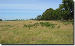 Example of landscape near Munro (Fernbank with Perry mapping unit). |
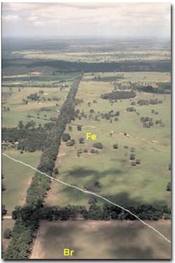 Photo looking east near the corner of Boundary and Saw Pit Roads south of Briagolong, showing some remnant vegetation. |
Most of the soils on this map unit are texture contrast soils, which means that they have light textured surface soils (gravelly loamy sands to sandy loams, commonly stony) abruptly overlying clay. Stones throughout the profile, up to 100 mm in diameter, are a common feature of many of the soils, particularly on hill slopes and the flanks of drainage lines. In exposures, the soils are mottled red and grey and in some localities gravelly ironstone crops out on the sides of valleys (Ward, 1977). There may be the occasional sand dune on this map unit. These dunes become a feature of this landscape further east and are mapped as the Perry Land System by Aldrick et al. (1992). The surface soils are generally dark greyish brown hard-setting gravelly loamy sands to sandy loams. Stones, up to 100 mm diameter, are a common feature. A bleached sub-surface (typically pale brown to pale brownish grey) horizon of similarly textured material occurs abruptly, overlying mottled yellow and brown clays, at about 30 to 50 cm. Large columnar structure is common in the upper subsoil. Clays or sandy clays, generally mottled with red colours, normally continue to at least one metre depth, often accompanied by gravel and stones. The soils in this unit are most likely to be classified as Yellow or Brown Sodosols using the Australian Soil Classification. Soil Site GP83 is an example of a Brown Sodosol near Fernbank. |
Chemical and Physical Analysis
Only one site Site GP83 has been examined in this unit. It is characterised by a sodic to strongly sodic subsoil that is also magnesic i.e. has very low levels of exchangeable calcium compared to exchangeable magnesium.
Land Use
Most of the soils are cleared and used for grazing and would be too stony for cropping.
| Fernbank and Variable Drainage Lines (Fe:dv) This symbol denotes areas where there is between 30% and 70% of either map unit. In general the soils on the flanks of the depressions are quite stony. | 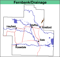 |
| Fernbank with Perry (Fe/Py) This map unit comprises mainly Fernbank with less than 30% of the Perry map unit. The Perry map unit is comprised of sand sheets and low dunes. | 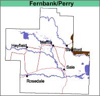 |
© State of Victoria (Agriculture Victoria) 1996 - .

This work, Victorian Resources Online, is licensed under a Creative Commons Attribution 4.0 licence. You are free to re-use the work under that licence, on the condition that you credit the State of Victoria (Agriculture Victoria) as author, indicate if changes were made and comply with the other licence terms.
The licence does not apply to ‘branding’ or some ‘images or photographs’ that may be owned by third parties. We ask you to seek prior approval to use images using the VRO feedback form. Access to higher quality images can also be provided on request.
This page was last updated on .