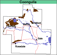
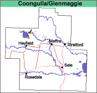
Coongulla (Cg)5
Geology
Freshwater sediments, mainly alluvium and fan deposits, deposited during the Pliocene to Early Pleistocene Epochs (5 to 1.8 mya).
Landform
Rolling low hills. The terrain is weakly to moderately dissected.
An interactive visualisation of the landscape in the Coongulla mapping unit is provided here. Zooming and panning functionality is provided as well as the ability to click on icons to provide further information about the landscape (e.g. soils, geology).
Photo
Panoroma
Information
Soil site
Video
NOTE: To leave panorama press 'Ctrl' and 'F5'.
Use your mouse and the on screen controls to navigate the study area.
To zoom in or out, use the + and - (inside the magnifying glass) or use the mouse's 'scroll wheel' (if you have one).
To explore the landscape, click and hold inside the landscape and move the mouse left, right, up or down or use the 'cursor keys'.
Original Vegetation
The original vegetation was a mixed forest mainly comprising Stringybark and Box. Eucalyptus globoidea is dominant with other species including E. sideroxylon, E. tereticornis, E. muellererana and E. goniocalyx (Aldrick et al. 1992). Much of the area has now largely been cleared.
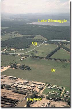
This photo indicates the position in the landscape of the Coongulla map unit and the density of the vegetation that occurs on it.
Previous Maps and Reports
This map unit is included within the Stockdale Land System as described by Aldrick et al. (1992).
Soils
Most of the soils on this map unit are texture contrast soils, with hard-setting gritty loam to fine sandy clay loam surface soils abruptly overlying yellowish brown and yellow mottled clays from about 25 to 40 cm. Quartz gravel and small stones are a common feature of these soils. Remnants of lateritic material, or strongly cemented conglomerate, often termed ironstone, may occur at the surface or within the soil profile. Small, localised areas of deep sand may occur within this map unit.
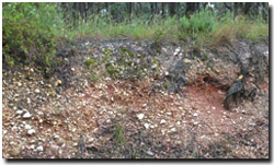
Stony soil profile in road cutting near Lake Glenmaggie.
Chemical and Physical Analysis
In lower rainfall areas the subsoils appear to be dispersive and are likely to be sodic. The surface soils are likely to have a pH less than 5.5. The soils are generally classified as Yellow or Brown Sodosols using the Australian Soil Classification. In higher rainfall areas, the subsoils may be strongly acid and these soils are classified as Kurosols. Site GP85 is an example of a Brown Kurosol located near Lake Glenmaggie.
Land Use
Most of the soils are cleared and used for grazing. They have little horticultural potential.
Coongulla with Glenmaggie (Cg/Gm)
This map unit is similar to Coongulla, but 30% or less of the area is comprised of the Glenmaggie map unit.
Coongulla and La Trobe (Cg:Lt)
This is a complex map unit comprising between 30% and 70% of either unit.
