
Athlone (Al)
|
Geology | 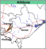 |
Gently undulating rises, possibly a dissected paleosurface. The landscape is gently undulating with deeply incised valleys, giving a hilly overall impression.
| Land Use The soils of this mapping unit have been regarded in the past as being among the poorer soils because they are very acidic. The clearing of remnants of the former forest continued until fairly recently. | 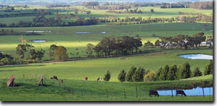 Landscape in the Athlone mapping unit near Nyora. |
The soils fall mainly within two groups. Those occurring on the very gently inclined areas with less than about 2 or 3% slope (Component 1) and those occurring on the gently to moderately inclined areas of greater slope (Component 2). Component 3 occurs in the drainage lines.
Component 1
The surface soils range from very dark greyish brown fine sandy loams to silty clay loams. This overlies a dark greyish brown (mottled with brownish yellow) similarly textured subsurface soil at about 10 to 20 cm. At about 30 to 40 cm, the subsoil changes to a greyish brown (mottled with yellowish brown) very fine sandy loams to very fine sandy clay loams, generally conspicuously bleached in patches. The upper part of this horizon is often cemented, in which case, the colours are predominantly very dark greyish brown and strong brown. At about 50 cm, mottled greyish brown, brownish yellow and reddish brown light clays become medium clays. Decomposing Cretaceous mudstone usually appears from about 1 metre depth.
The soils would be mostly described as Acidic Mesotrophic, Yellow or Grey Dermosols using the Australian Soil Classification. Soil Site GP55 is an example of an Acidic Grey Dermosol in the Kernot area.
Component 2
The surface soils range from very dark greyish brown clay loams to very fine sandy clay loams overlying a dark greyish brown to brownish grey similarly textured subsurface soil at about 10 to 20 cm. This generally becomes mottled with yellowish brown at depth. Depending on the soil’s position on the slope and the degree of slope, there is a clear transition to light clays from about 40 cm. Light medium clays occur with depth, generally mottled greyish brown and brownish yellow in colour. Decomposing Cretaceous mudstone appears from about 1.0 metre.
Often the texture transition between the sub-surface soil and the clay subsoil is more gradual than described above.
Soil Site GP79 and Site GP80 are examples of Acidic Brown Dermosols near Athlone.
Component 3
The soils in the drainage depressions occupy less than 10% of this mapping unit. Insufficient information has been recorded to give a reliable description of this component. Soil Site GP81 is an example of a Hydrosol in a drainage depression near Athlone.
© State of Victoria (Agriculture Victoria) 1996 - .

This work, Victorian Resources Online, is licensed under a Creative Commons Attribution 4.0 licence. You are free to re-use the work under that licence, on the condition that you credit the State of Victoria (Agriculture Victoria) as author, indicate if changes were made and comply with the other licence terms.
The licence does not apply to ‘branding’ or some ‘images or photographs’ that may be owned by third parties. We ask you to seek prior approval to use images using the VRO feedback form. Access to higher quality images can also be provided on request.
This page was last updated on .