
Tynong (Ty)
|
Landform | 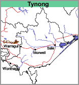 |
The soils fall into two broad groups, those containing mostly clay and the other mostly gravel. The first group has dark brownish grey clay loam or loam surfaces about 20 cm deep, often with slight amounts of grit, overlying a bleached layer of similar texture. Mottled yellowish brown and light grey medium or heavy clays, often gritty, occur from about 50 cm depth. Apart from variations in grittiness, these clays continue with little change to 180 cm. Soil Pit Site GP82 is an example of a gritty Grey Sodosol near Labertouche (which also contains a discontinuous 'coffee rock' layer).
The other group occurs generally in the narrow and upper parts of the valleys and is much less extensive than the above soils. It has dark grey gravelly loam surfaces which pass to light grey gravelly loams at about 15 cm depth. At about 60 cm depth, mottled light grey and yellowish brown clayey gravels occur which are frequently cemented and impenetrable with a soil auger. Less cemented but mottled light grey, yellowish brown and reddish brown gravels or gravelly clays occur from about 90 cm depth.
© State of Victoria (Agriculture Victoria) 1996 - .

This work, Victorian Resources Online, is licensed under a Creative Commons Attribution 4.0 licence. You are free to re-use the work under that licence, on the condition that you credit the State of Victoria (Agriculture Victoria) as author, indicate if changes were made and comply with the other licence terms.
The licence does not apply to ‘branding’ or some ‘images or photographs’ that may be owned by third parties. We ask you to seek prior approval to use images using the VRO feedback form. Access to higher quality images can also be provided on request.
This page was last updated on .