
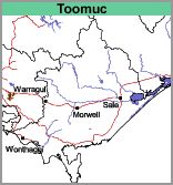
Toomuc (To)
 | Geology Recent to Pleistocene alluvium with some aeolian deposits. Landform Gently undulating sand plain. |
Soils
The surface soils are dark grey to dark greyish brown sands to sandy loams about 25 cm deep, overlying a bleached layer of similar texture. Nodules of iron oxide are common at the base of this layer. Mottled medium to heavy clays occur from about 40 to 60 cm depth, with light grey, brownish yellow and yellowish brown colours predominating and continuing to at least 150 cm. Red-brown mottling and medium to heavy clay, occasionally sandy clay, textures generally occur in the deep subsoil. Soil Site GP21, a Sodosol, is an example of a shallow version of a soil typical of the Toomuc map unit.
Land Use
Originally this map unit supported wet heath to wet scrub on the low dunes and lightly timbered grassland on the sandy plain. The wet heath comprised silver banksia, scrub she-oak, swamp and scented paperbark, prickly tea-tree, heath, sedges and grasses, with occasional manna gum. The sandy plains were probably grassland with scattered swamp paperbark, manna gum and swamp gum.
Most of this map unit now carries pasture utilised mainly by beef and dairy cattle but some sheep are also grazed. Where soils of the Toomuc map unit occur within or near the soils of the Cranbourne Association some vegetable crops may be grown. These soils are very prone to waterlogging and the "spewy" nature of the bleached zone when saturated makes cultivation difficult.
© State of Victoria (Agriculture Victoria) 1996 - .

This work, Victorian Resources Online, is licensed under a Creative Commons Attribution 4.0 licence. You are free to re-use the work under that licence, on the condition that you credit the State of Victoria (Agriculture Victoria) as author, indicate if changes were made and comply with the other licence terms.
The licence does not apply to ‘branding’ or some ‘images or photographs’ that may be owned by third parties. We ask you to seek prior approval to use images using the VRO feedback form. Access to higher quality images can also be provided on request.
This page was last updated on .