
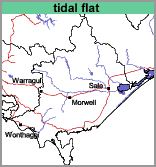
Tidal Flat (td)
 | Geology Recent marine sediments. Landform Marine plain. Soils The soils of this mapping unit are quite variable and range from black to very dark grey highly organic clays to fine sands. As they are subject to tidal influences and are mostly saturated they would be termed Intertidal Hydrosols using the Australian Soil Classification. Land Use This mapping unit should not be used for agriculture. |
© State of Victoria (Agriculture Victoria) 1996 - .

This work, Victorian Resources Online, is licensed under a Creative Commons Attribution 4.0 licence. You are free to re-use the work under that licence, on the condition that you credit the State of Victoria (Agriculture Victoria) as author, indicate if changes were made and comply with the other licence terms.
The licence does not apply to ‘branding’ or some ‘images or photographs’ that may be owned by third parties. We ask you to seek prior approval to use images using the VRO feedback form. Access to higher quality images can also be provided on request.
This page was last updated on .