
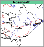
Roseneath (Rn)
- Roseneath, clay surface (Rn,c)
- Roseneath, sandy loam surface (Rn,sl)
- Roseneath, clay surface and Roseneath, sandy loam (Rn,c:Rn,sl)
 |
Geology
Holocene sediments (Mostly Qrm with some Qrd – see Geology and Geomorphology) which were most likely deposited under paludal or lacustrine conditions (lake or marshy conditions).
Landform
Marine plain.
Soils
Two main soil types have been identified on the map, Roseneath clay surface (Rn,c) and Roseneath sandy loam surface (Rn,sl).
© State of Victoria (Agriculture Victoria) 1996 - .

This work, Victorian Resources Online, is licensed under a Creative Commons Attribution 4.0 licence. You are free to re-use the work under that licence, on the condition that you credit the State of Victoria (Agriculture Victoria) as author, indicate if changes were made and comply with the other licence terms.
The licence does not apply to ‘branding’ or some ‘images or photographs’ that may be owned by third parties. We ask you to seek prior approval to use images using the VRO feedback form. Access to higher quality images can also be provided on request.
This page was last updated on .