
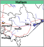
Hallam (Ha)
 | Geology Silurian sedimentary rock, usually mudstone, generally occurring at between 1 and 2 metres depth. Landform Undulating to rolling low hills. Soils The surface soils are generally dark grey or greyish brown very fine sandy clay loams to silty clay loams. At about 10 cm a bleached zone occurs, similar in texture to the above layer. Yellowish brown mottled with light grey, medium to heavy clays occur at 35 to 50 cm, with a zone of ironstone concretions above the clay. |
Variations in colour and texture of the surface soils, as well as depth to rock, occur depending on landscape position. Most of the soils are believed to be yellow and brown Chromosols, although some yellow and brown Sodosols may also occur.
On the steeper slopes the soils are subject to sheet erosion and consequently, the depth of the surface soil is much less. Shallow, rocky soils occur without the presence of a clay horizon. These are regarded as non-agricultural soils, apart from grazing on the relatively sparse grass cover.
Land Use
Most of the soils of this map unit originally carried an open forest or shrub woodland. However, north of Pakenham there are areas of wet sclerophyll forest. Although most of the land is cleared, there are sufficient areas of relatively natural vegetation present to identify the original plant communities. The predominant eucalypts are messmate and silver-leaf stringybark, with longleaf box, narrow-leaf peppermint and the occasional manna gum.
Where slopes are not excessive, the soils can be quite well suited to apples and peaches. Pears and cherries are grown to a lesser extent. Vegetable crops such as cabbages, cauliflowers and brussels sprouts as well as cut flowers (mainly jonquils, daffodils and chrysanthemums) are also grown. Otherwise the soils are sown to pasture for grazing.
© State of Victoria (Agriculture Victoria) 1996 - .

This work, Victorian Resources Online, is licensed under a Creative Commons Attribution 4.0 licence. You are free to re-use the work under that licence, on the condition that you credit the State of Victoria (Agriculture Victoria) as author, indicate if changes were made and comply with the other licence terms.
The licence does not apply to ‘branding’ or some ‘images or photographs’ that may be owned by third parties. We ask you to seek prior approval to use images using the VRO feedback form. Access to higher quality images can also be provided on request.
This page was last updated on .