
Garfield (Ga)
| Geology Devonian granite and granodiorite. Landform Rolling low hills. Land use Most of the former open forest is now cleared and is generally sown to permanent pasture. There are also a number of apple orchards on these soils, mainly outside the study area. | 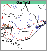 |
Soils
This mapping unit occurs on the lower foothills and is underlain by decomposing granite rock. Most of the soils are deeper than 1.8 metres but there are some rocky outcrops. The surface soils are generally brownish grey gritty or sandy clay loams with bleached subsurface horizons occurring at about 10 to 20 cm. At about 40 to 60 cm depth, slight amounts of small 'buckshot' (iron concretions) generally occur just above the subsoil. The yellow-brown and grey or pale grey light clay (occasionally medium clay) subsoils are mottled. At about 80 cm there are medium to heavy clays, usually gritty and generally continue to at least 1.8 metres.
© State of Victoria (Agriculture Victoria) 1996 - .

This work, Victorian Resources Online, is licensed under a Creative Commons Attribution 4.0 licence. You are free to re-use the work under that licence, on the condition that you credit the State of Victoria (Agriculture Victoria) as author, indicate if changes were made and comply with the other licence terms.
The licence does not apply to ‘branding’ or some ‘images or photographs’ that may be owned by third parties. We ask you to seek prior approval to use images using the VRO feedback form. Access to higher quality images can also be provided on request.
This page was last updated on .