
A review of new approaches to groundwater resource and salinity assessment using mining and oil industry 3D visualisation and quantification tools
|
The provision of reliable and up to date geological and hydrological data and models for groundwater resource management has gained importance recently with pressures on developing and/or protecting our groundwater resources. Developers, management authorities and government regulators must consider a range of issues, which may impact on the environmental, social and economic wellbeing of natural resources in the Victorian landscape, including groundwater. The application of a range of software tools to better understand our current natural resources, by analysing, manipulating or visualising natural resource information has increased in recent years. Modelling our current data sets and visualising those models is a key component of this understanding so that informed decisions can be made for resource development or protection. | 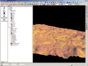 |
The focus of this review (published in 2006) is to identify alternative software and data options that may strengthen and improve our knowledge and understanding of the groundwater resource. This way we can integrate common groundwater information with different yet not unrelated data types from disparate sources into a more holistic view of the resource. Such data sources include information and knowledge collected and generated by the mineral exploration industry. Then also by using software options generally used in that industry to mix the exploration and groundwater data and knowledge to produce a better product. Mining software globally is a $2 billion a year industry with a 60% contribution from Australian software makers. This can be used as a platform to leverage and drive further development into groundwater research.
An examination of our current and potential future needs in data modelling and visualisation, coupled with an appraisal of the range of data sources available are presented. Seven software systems are reviewed, considered and summarised with mixed results. The development of this review aimed at forming closer links between the former Primary Industries Research Victoria (now Future Farming Systems Research Division of DPI) and GeoScience Victoria to share and find common ground in data/technology sharing. Likewise links have been formed with the Cooperative Research Centre for Spatial Information (external link) in software development and a North America research group in 3D applications for groundwater studies. This review, while not aiming to find the best tool to answer all the questions, has been able to identify a few contenders, which require further testing.
The end product may be a combination of tools or may require development of an existing software application. It has certainly been intended to raise the profile of existing tools into new areas of application. Technology transfer between interested parties identified above and ongoing communication will help to develop the ideas presented here further.
A review of new approaches to groundwater resource and salinity assessment using mining and oil industry 3D visualisation and quantification tools (PDF - 1.2 MB)
A review of new approaches to groundwater resource and salinity assessment using mining and oil industry 3D visualisation and quantification tools (DOC - 2 MB)
© State of Victoria (Agriculture Victoria) 1996 - .

This work, Victorian Resources Online, is licensed under a Creative Commons Attribution 4.0 licence. You are free to re-use the work under that licence, on the condition that you credit the State of Victoria (Agriculture Victoria) as author, indicate if changes were made and comply with the other licence terms.
The licence does not apply to ‘branding’ or some ‘images or photographs’ that may be owned by third parties. We ask you to seek prior approval to use images using the VRO feedback form. Access to higher quality images can also be provided on request.
This page was last updated on .